Selected Projects
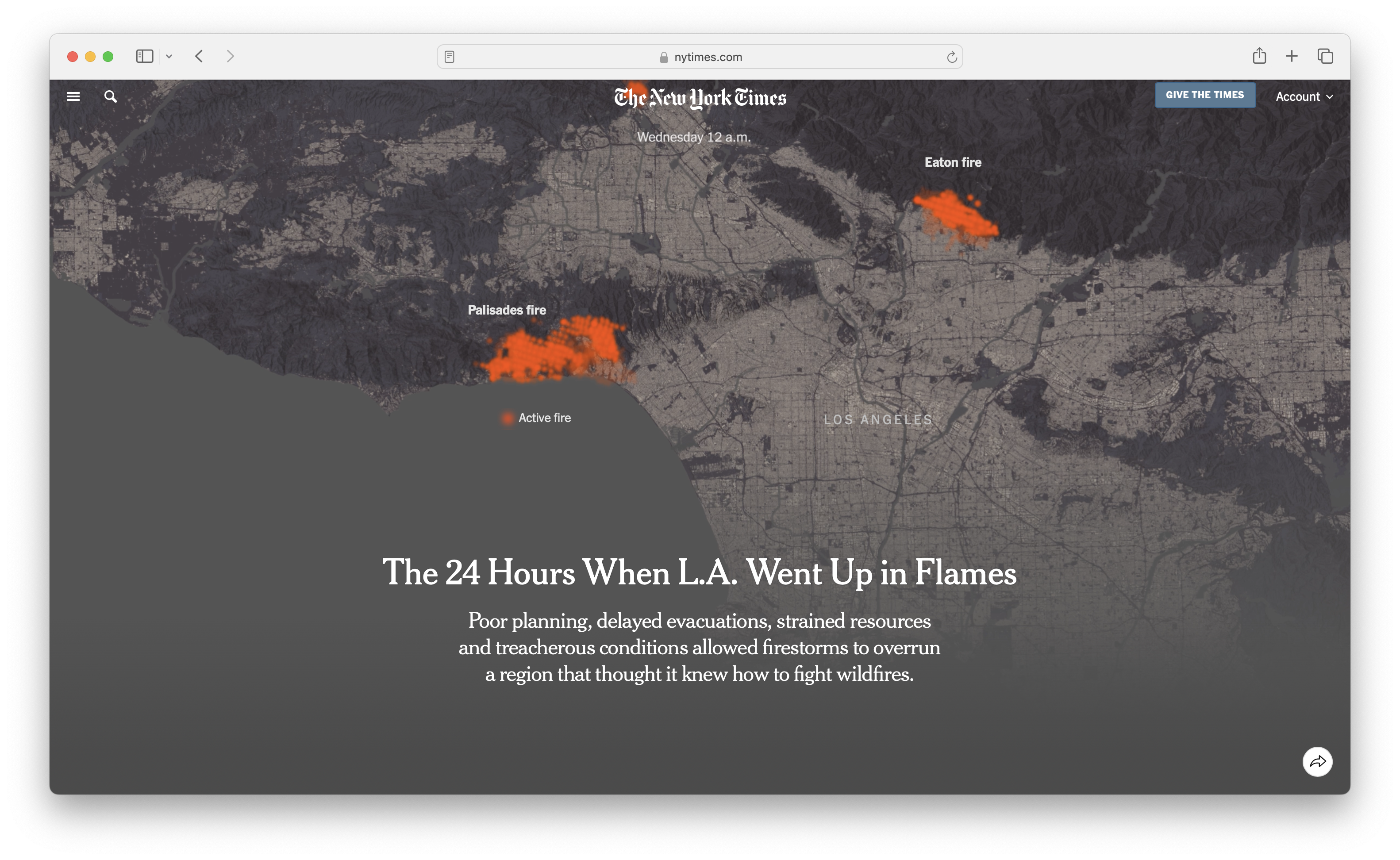
The 24 Hours When L.A. Went Up in Flames
A timeline of the first 24 hours of the LA fires [NYT]
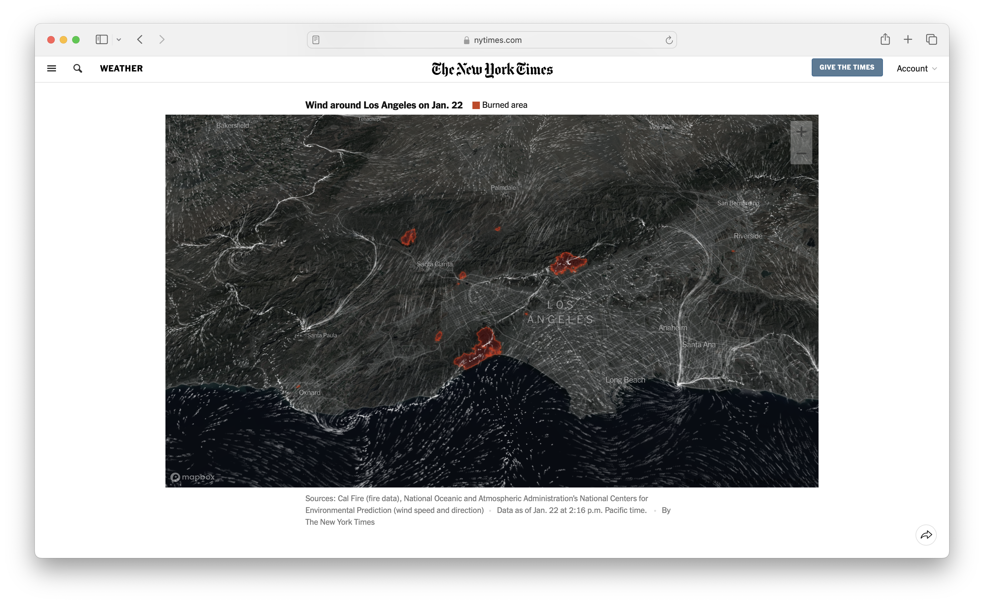
Maps: Tracking Southern California Wildfires
Maps and charts tracking the LA fires [NYT]
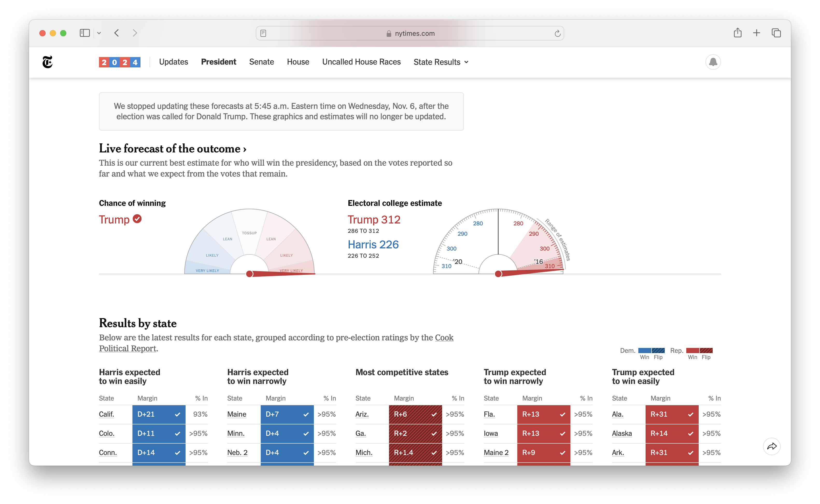
2024 US General Election
Data scraping for the 2024 US General Election [NYT]
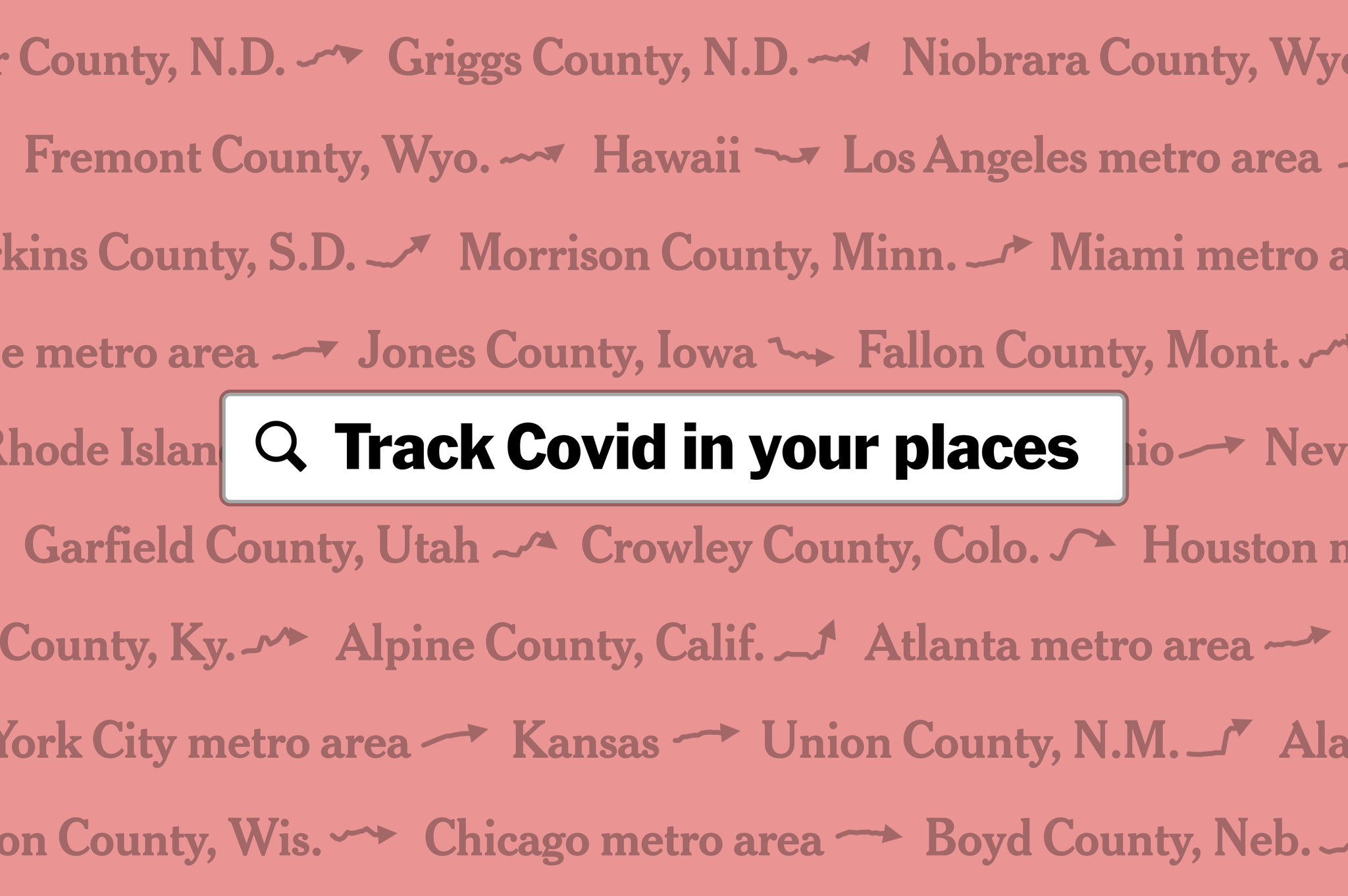
Personalized Coronavirus Tracker
Track Coronavirus in places you care about [NYT]
ml5.js
An opensource library for creative applications of machine learning on the web
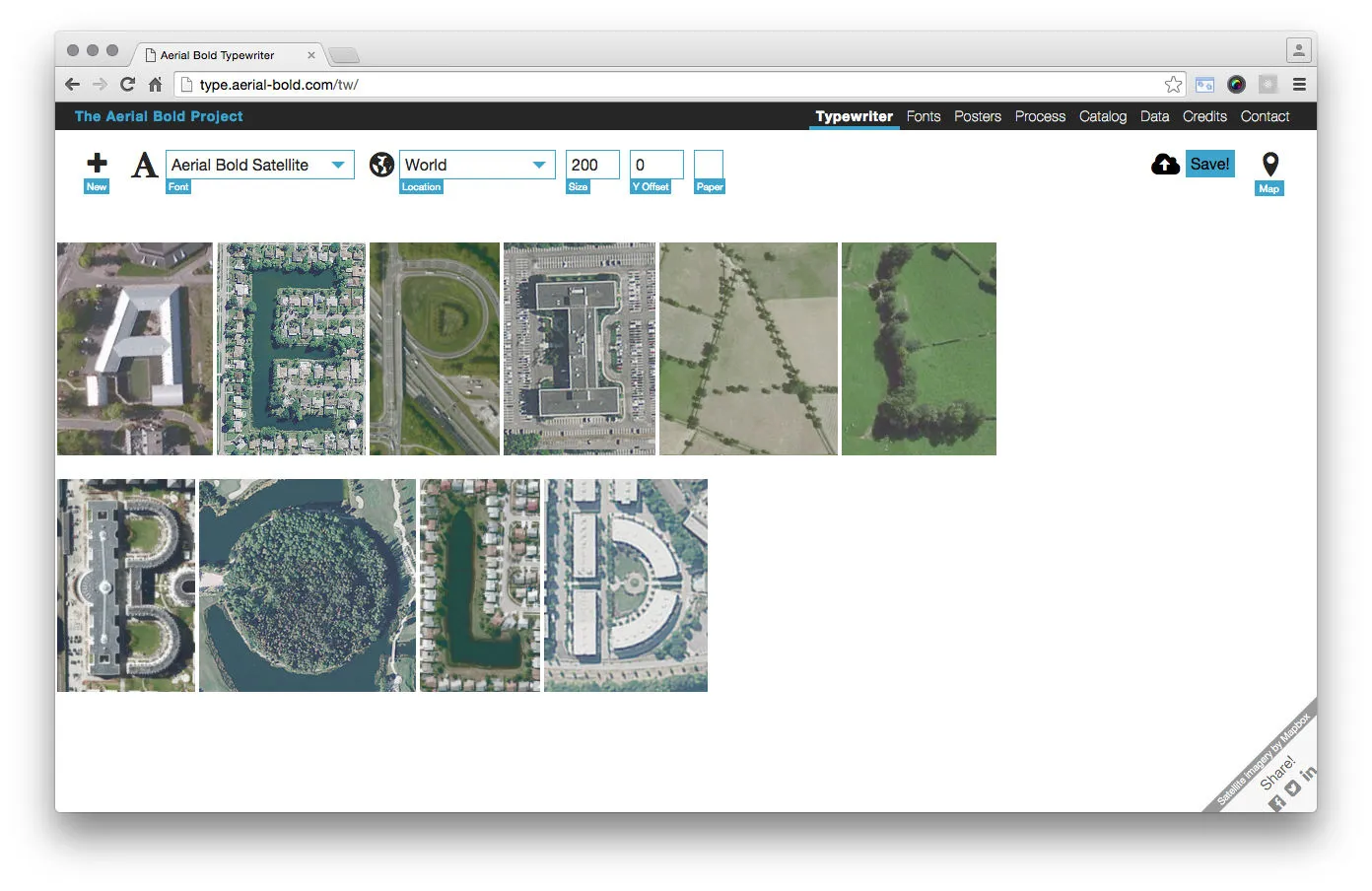
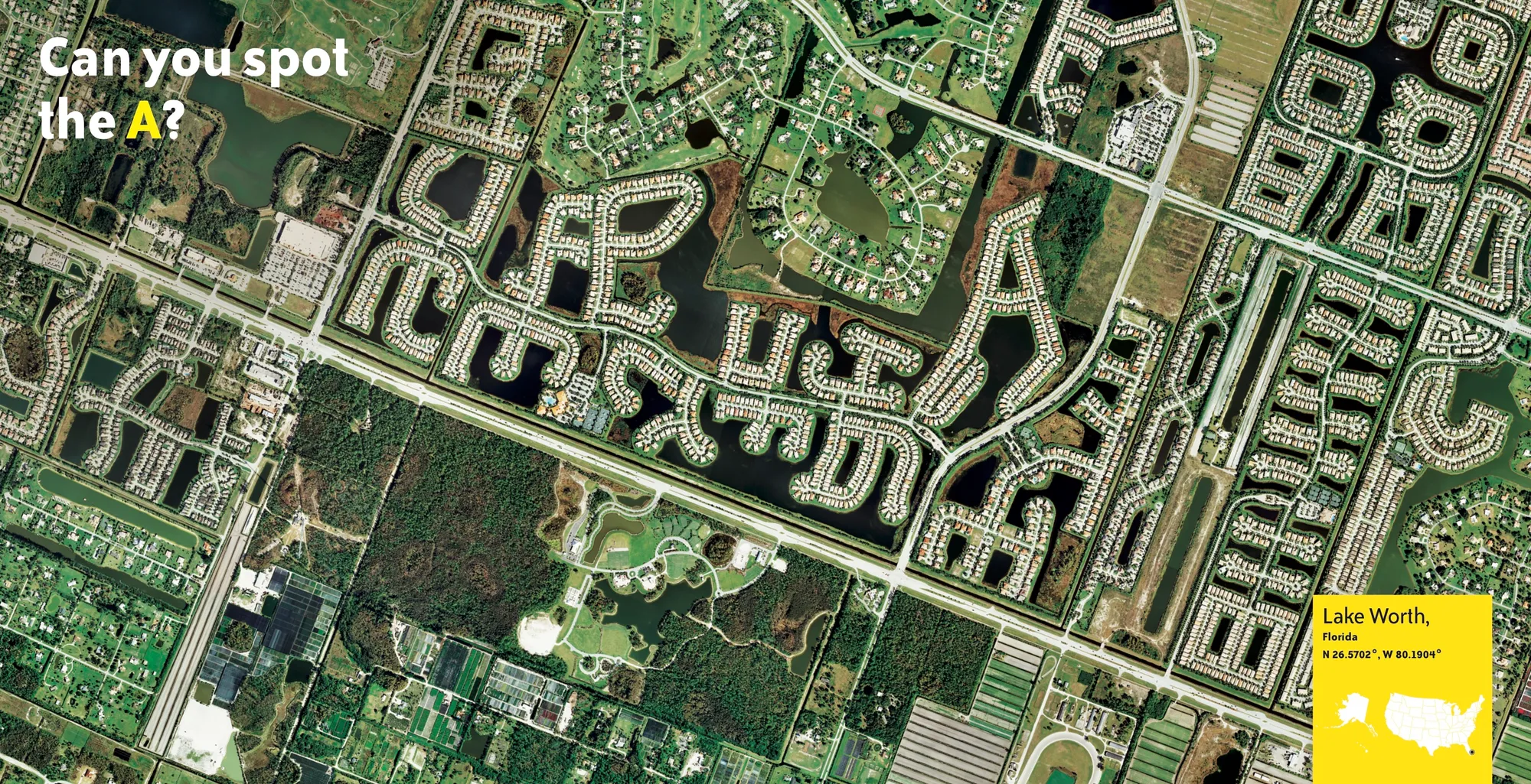
Aerial Bold
The Planetary Search for Letterforms

Generative Design 2.0
Contributions to the second version of Generative Design

The Big Atlas of LA Pools
The Big Atlas of LA Pools
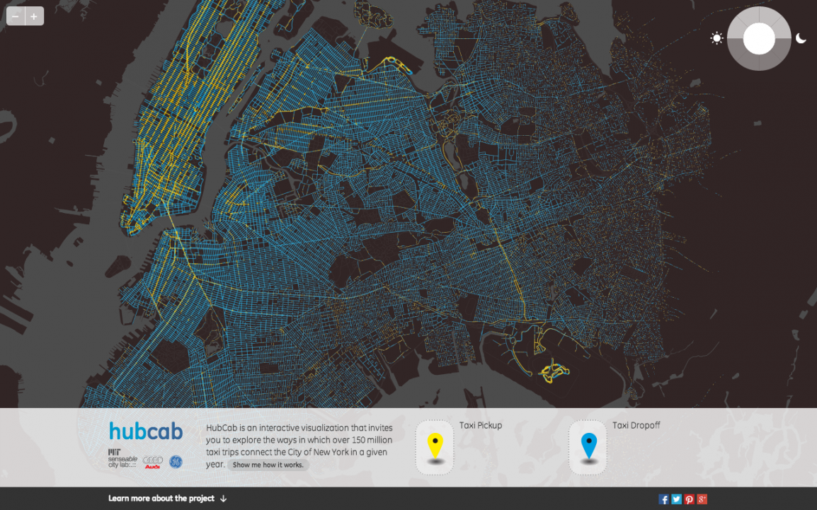
HubCab: Visualizing 170 Million NYC Taxi Trips
Visualizing 170 million taxi trips in NYC [MIT]
All Projects
The 24 Hours When L.A. Went Up in Flames
A timeline of the first 24 hours of the LA fires [NYT]
Maps: Tracking Southern California Wildfires
Maps and charts tracking the LA fires [NYT]

The Men and Women Swirling Around Elon Musk
A look at who influences Elon Musk [NYT]

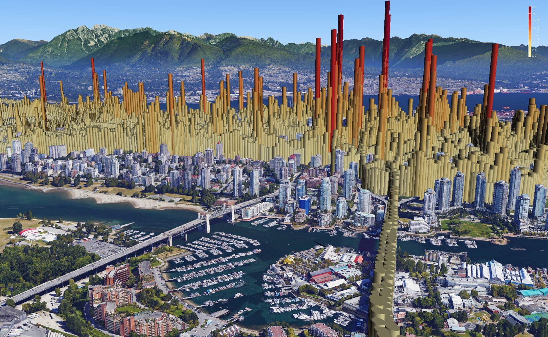
Maps Pinpoint Where Democrats Lost Ground Since 2020 in 11 Big Cities
Data scraping to help vote shift analyses [NYT]
2024 US General Election
Data scraping for the 2024 US General Election [NYT]
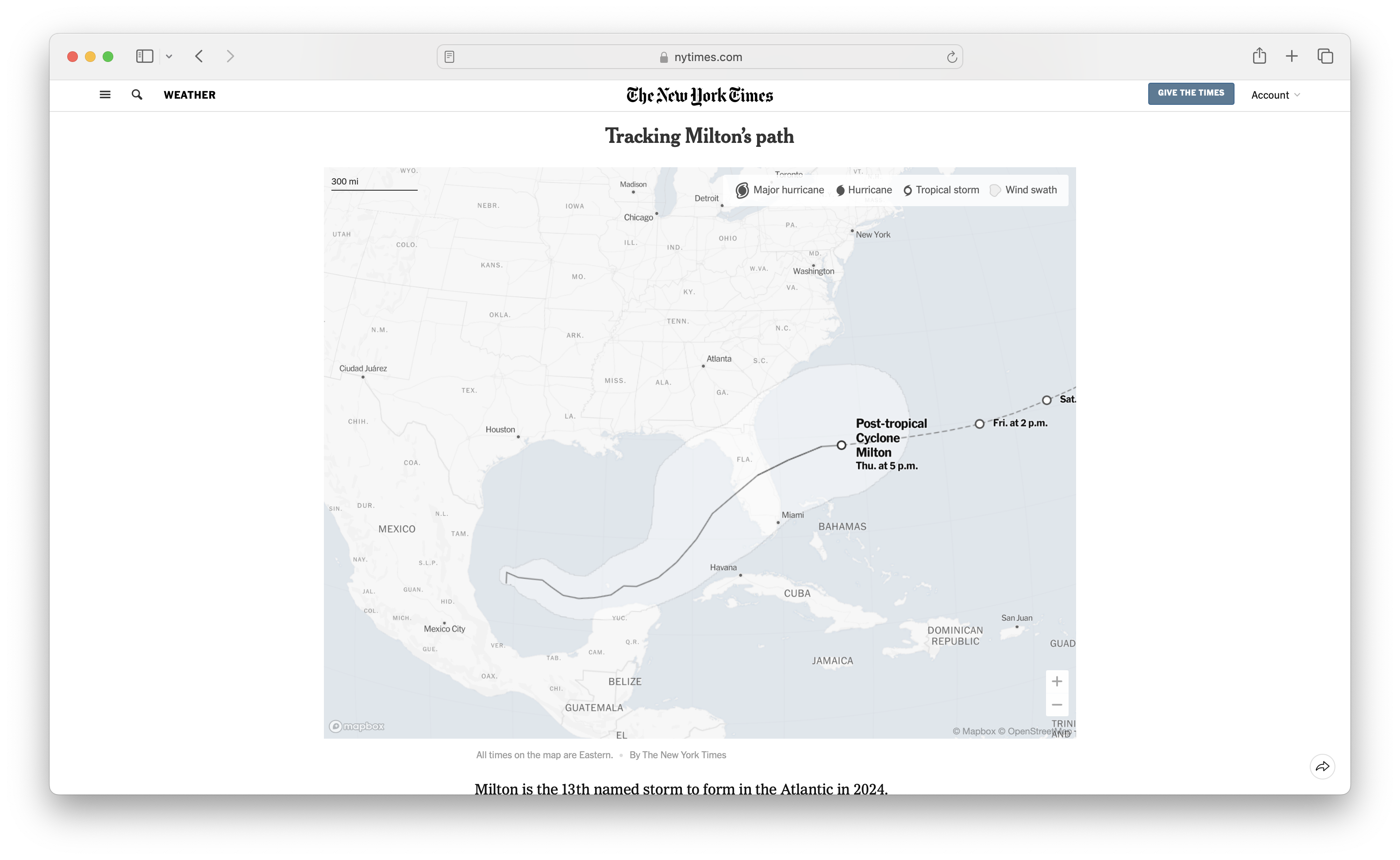
Tracking Hurricane Milton
Tracking Hurricane Milton [NYT]
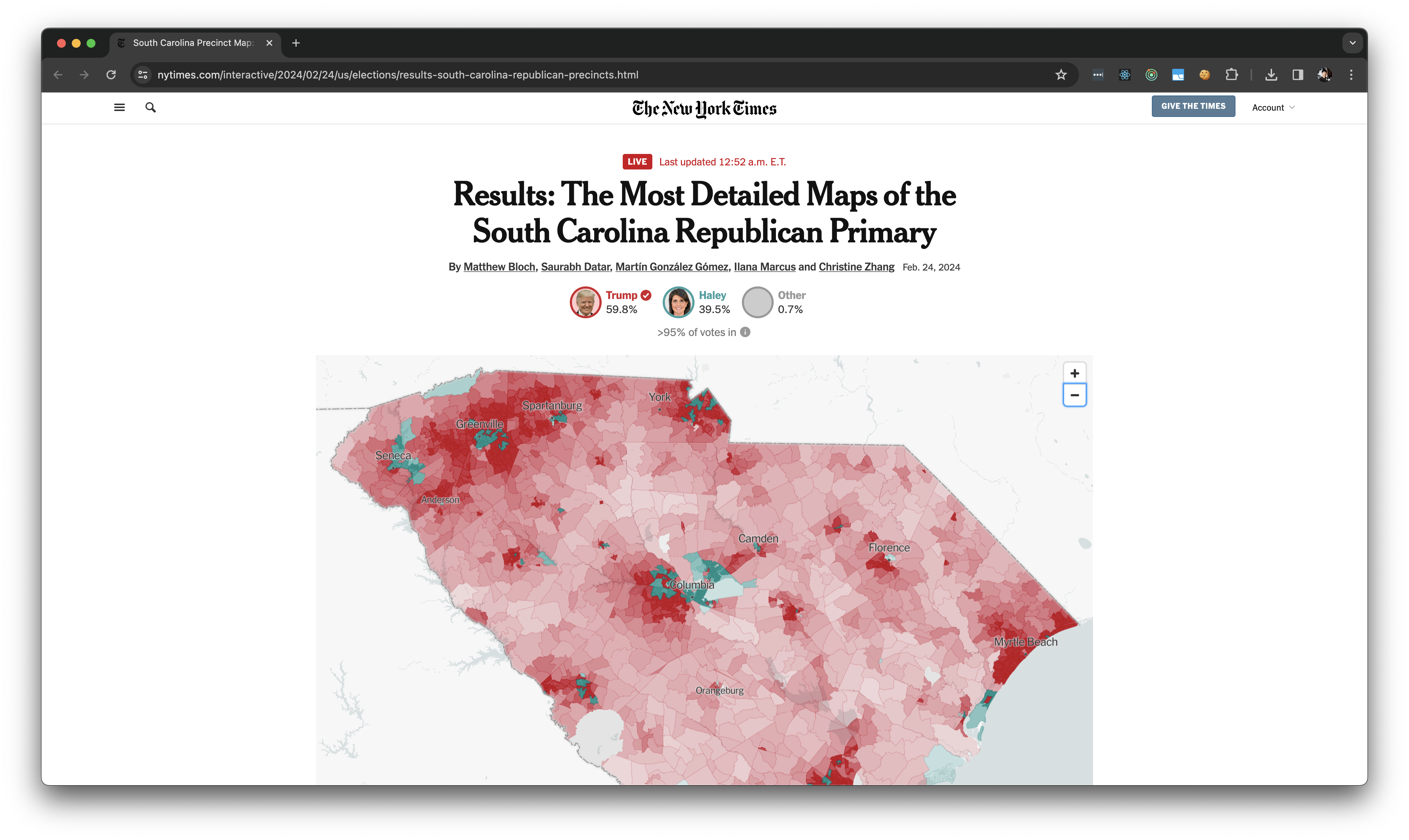
The Most Detailed Maps of the South Carolina Republican Primary
Data scraping for the S. Carolina Republican Primary [NYT]
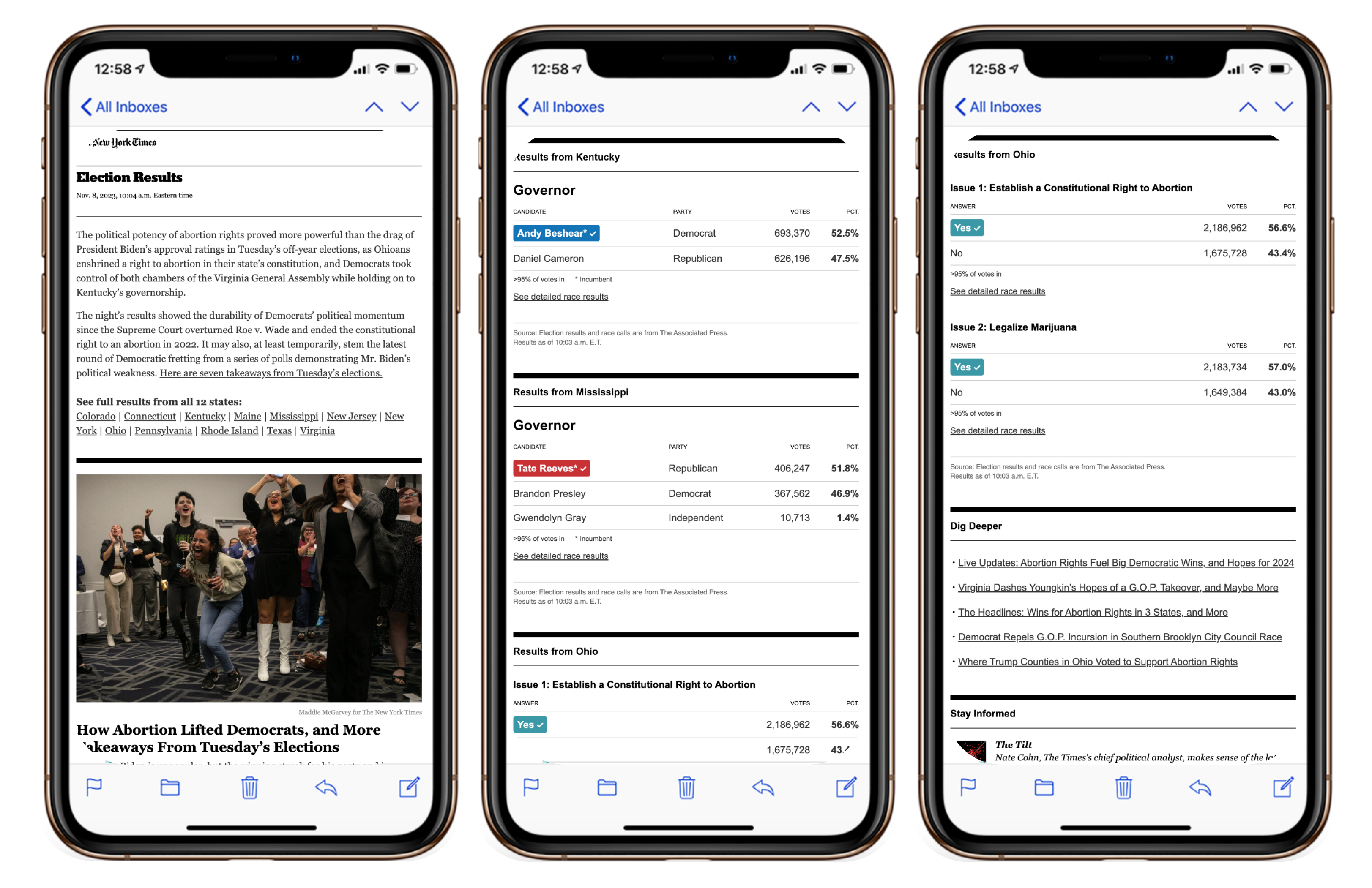
U.S. Election Results
Coverage of the U.S. election results [NYT]
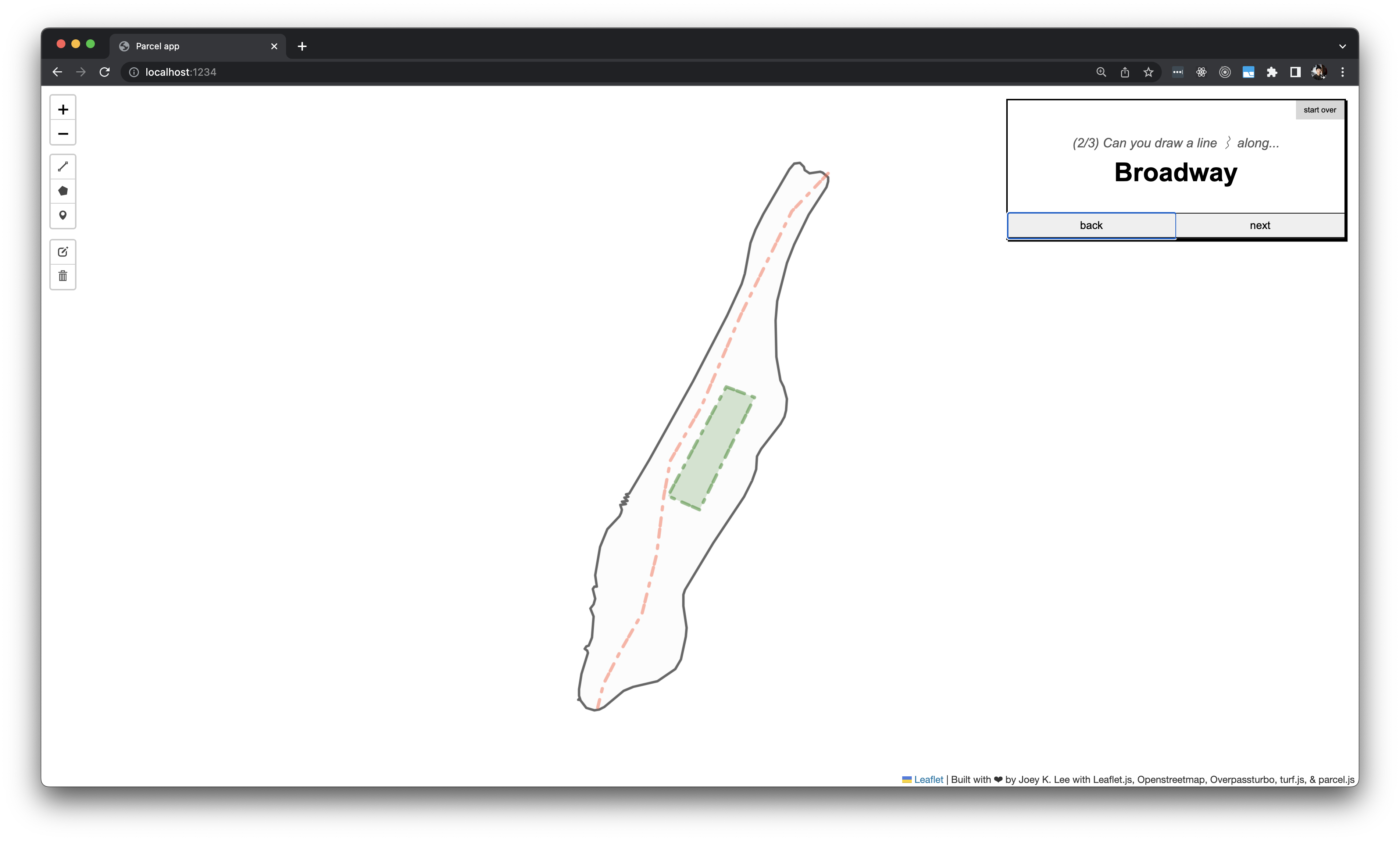
Ground Truth
A mental map game
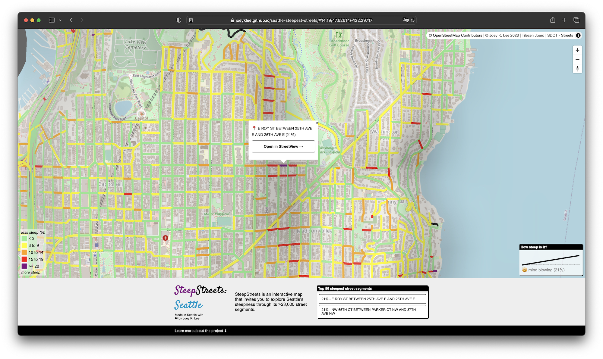
Seattle's Steepest Streets
A fun exploration of street steepness in Seattle
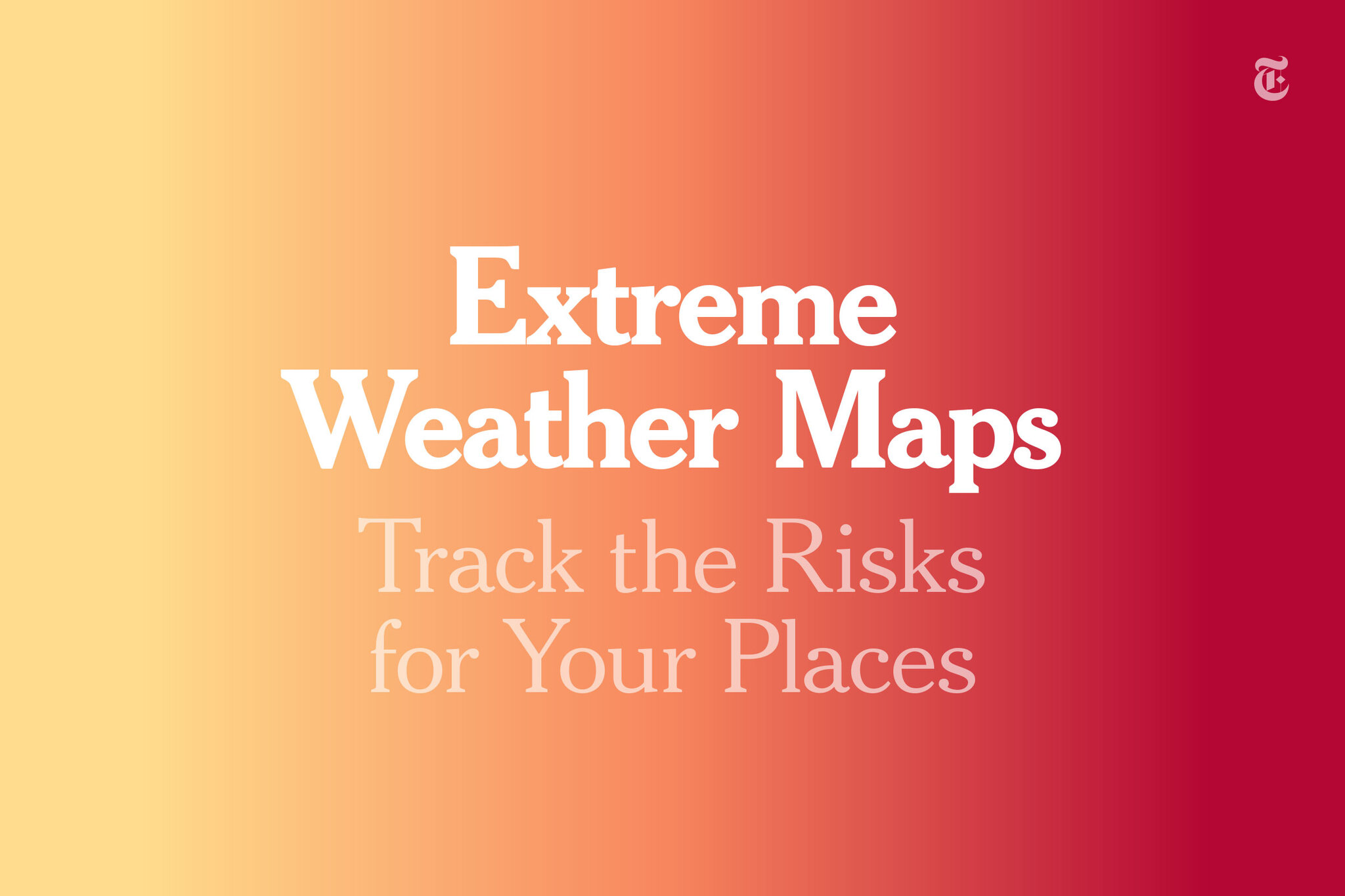
Your Places: Extreme Weather
Get updates about extreme weather in places you care about [NYT]
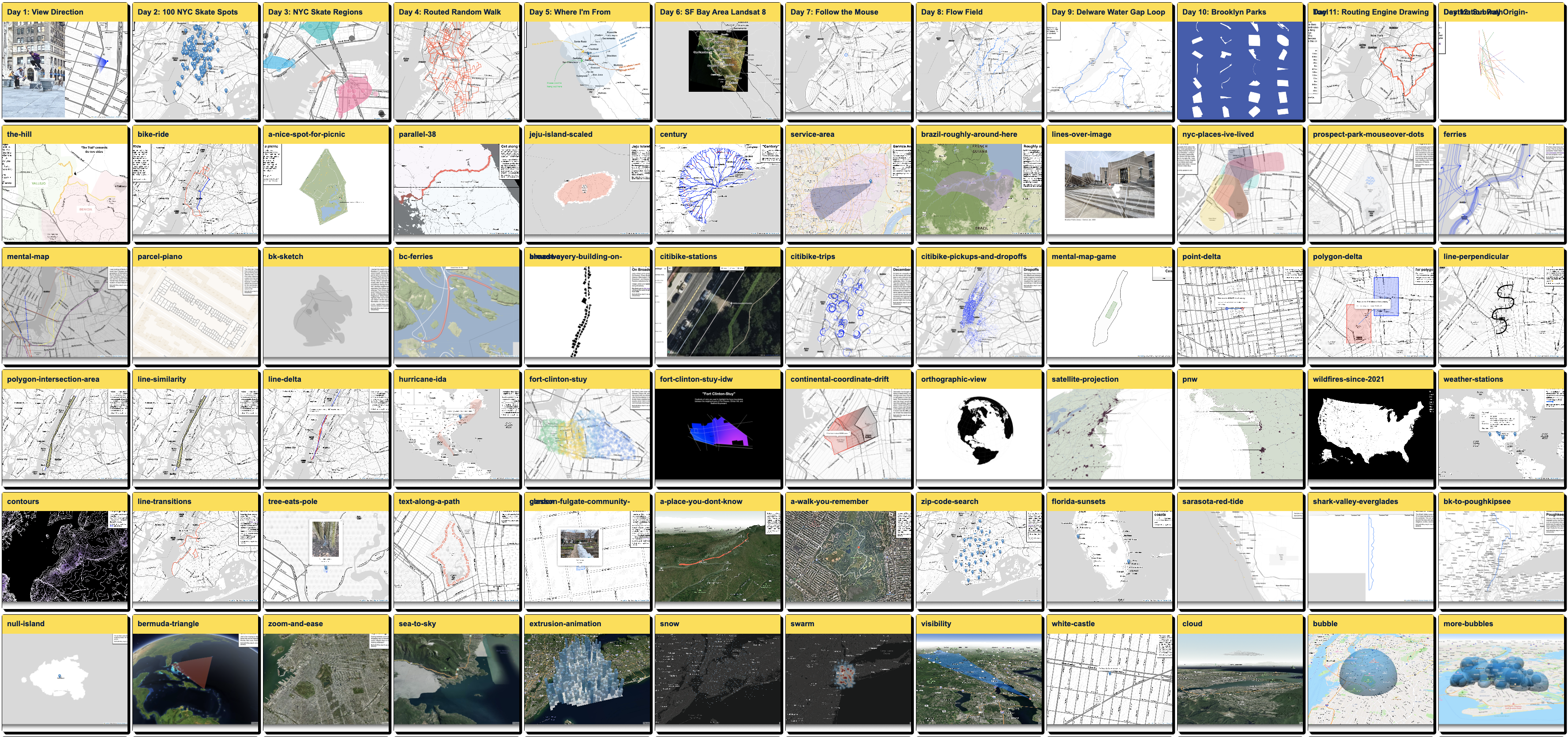
100 Days of Making: Everything is a Map
100 maps in 100 days

Sports newsletters at The New York Times
Custom graphics for sports newsletters at The New York Times [NYT]
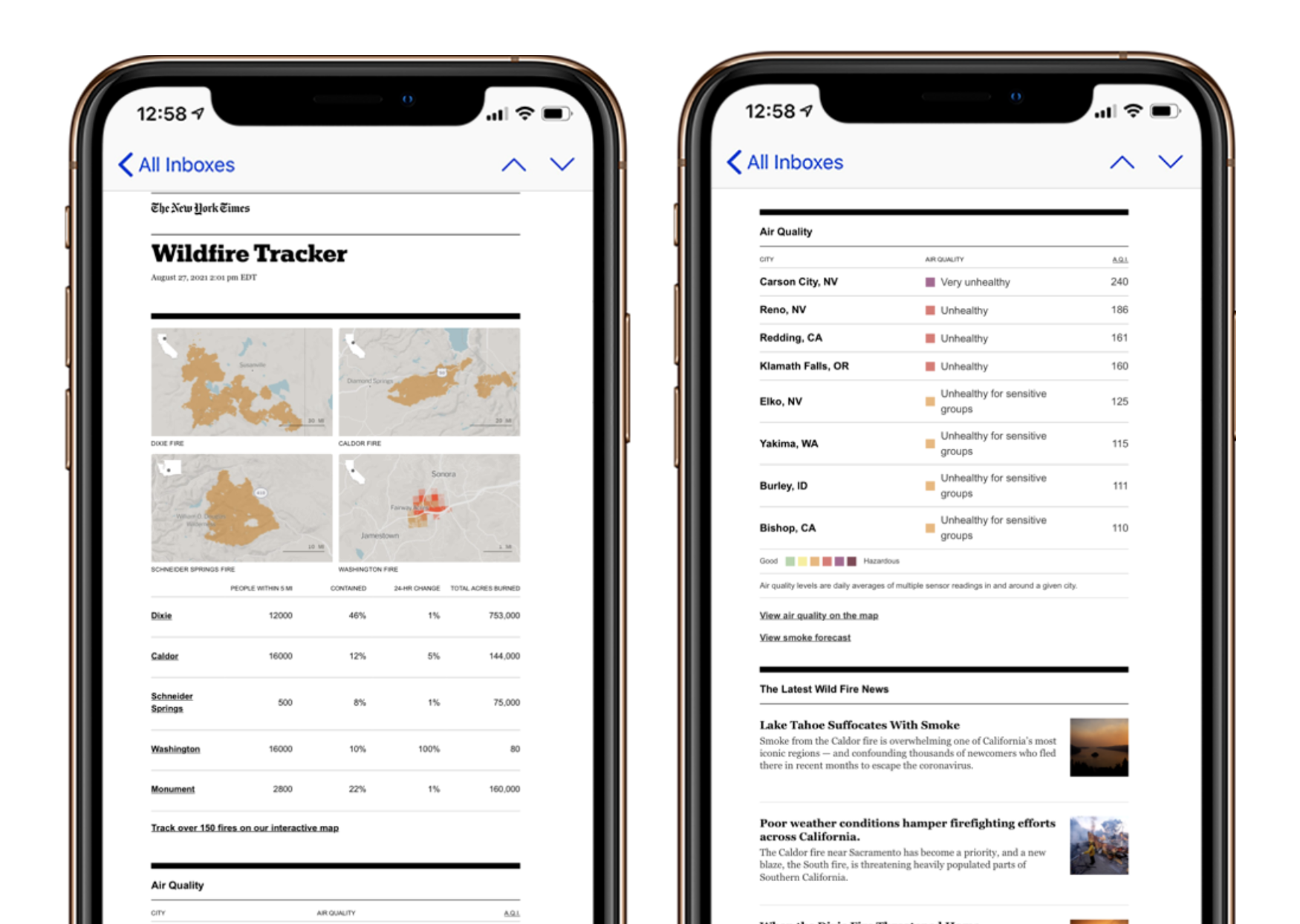
Wildfire Tracker Alert
Wildfire Tracker alert email [NYT]
Personalized Coronavirus Tracker
Track Coronavirus in places you care about [NYT]
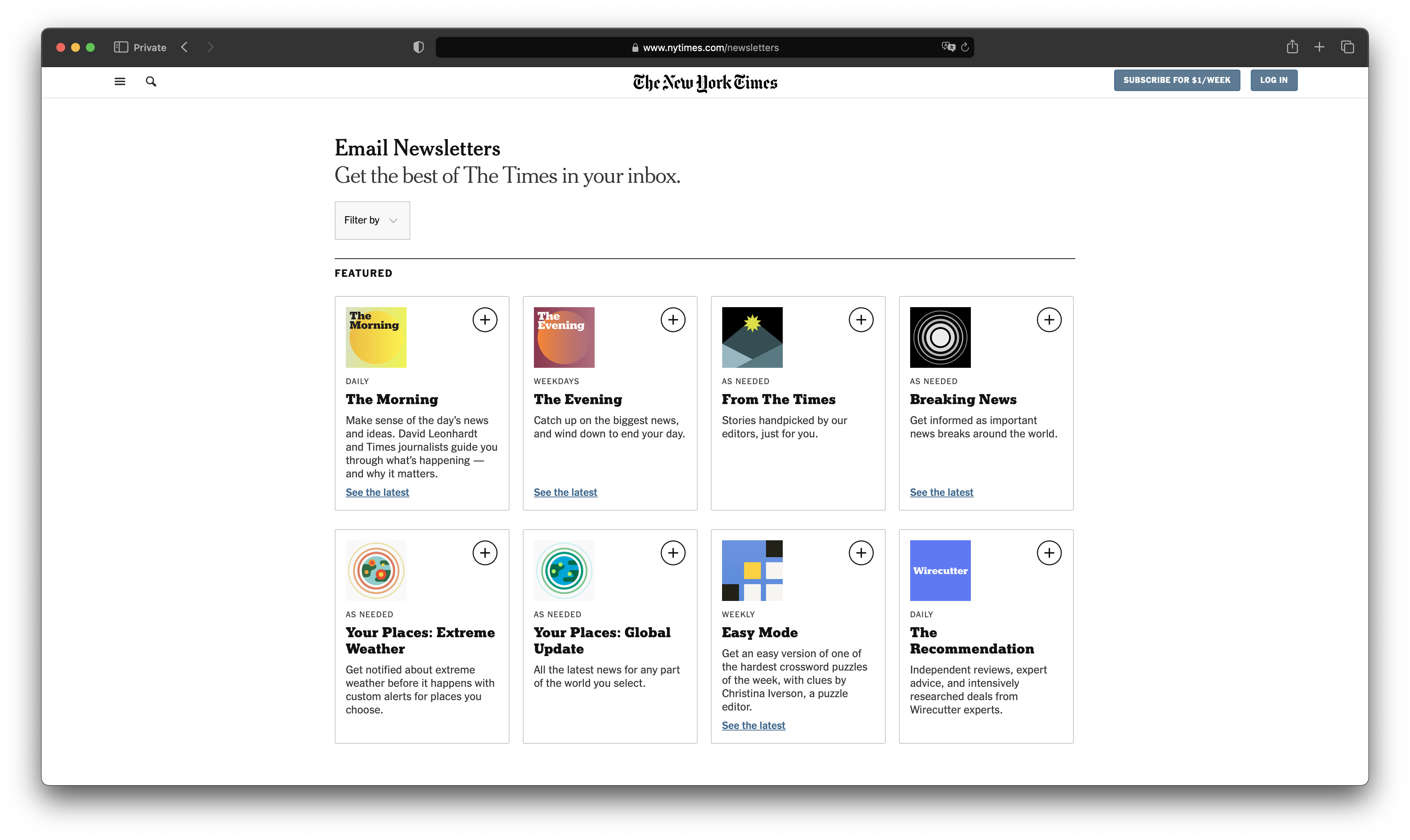
Newsletters at The New York Times
Messaging & Personalization [NYT]
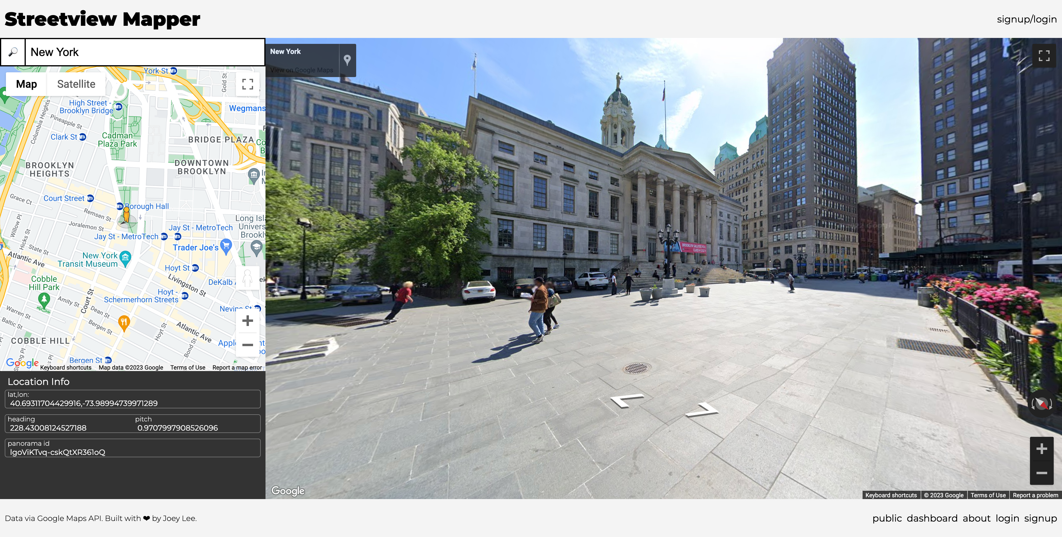
Streetview Mapper
A tool to take and share snapshots of the world through StreetView
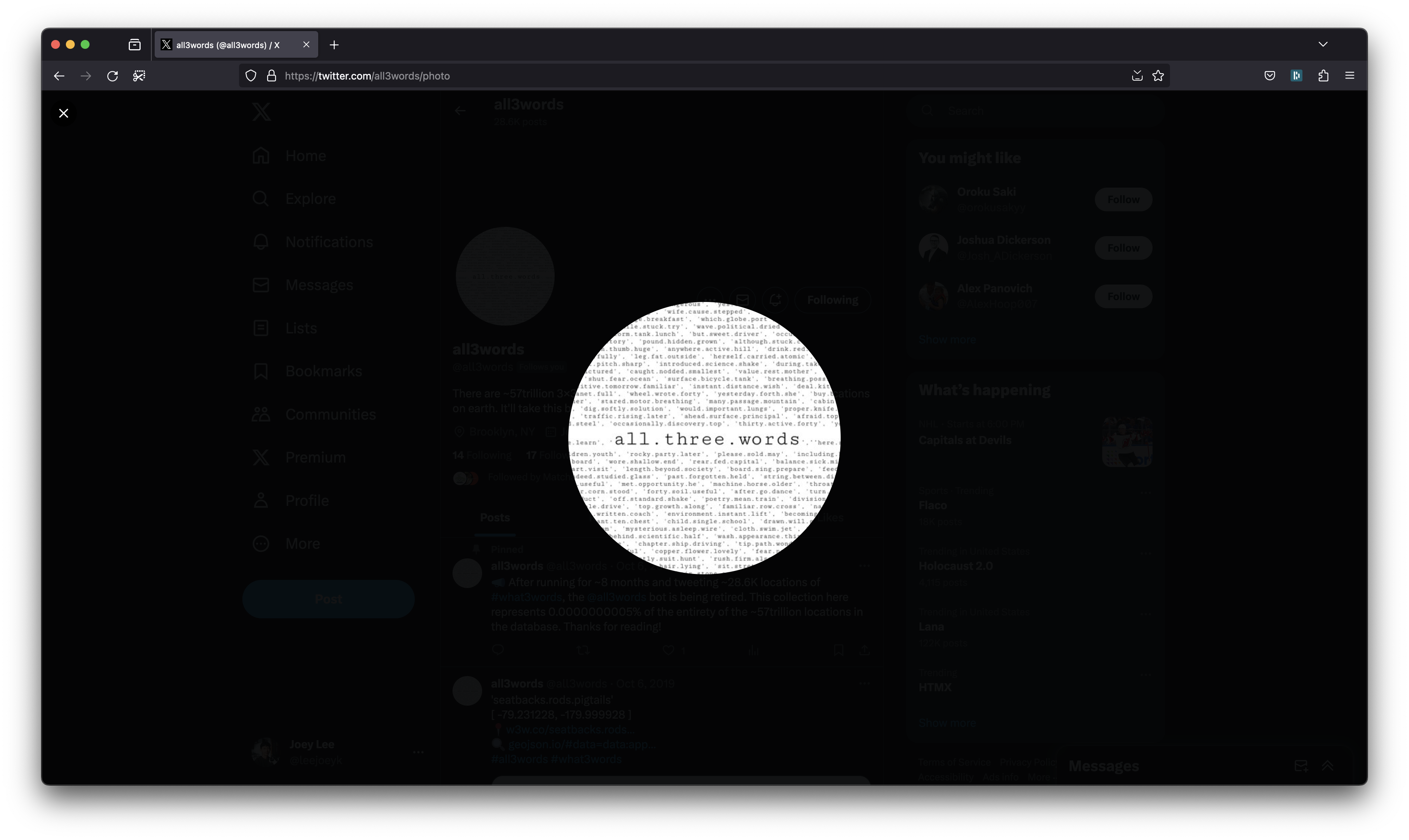
All3Words
An attempt to tweet every location in the what3words database
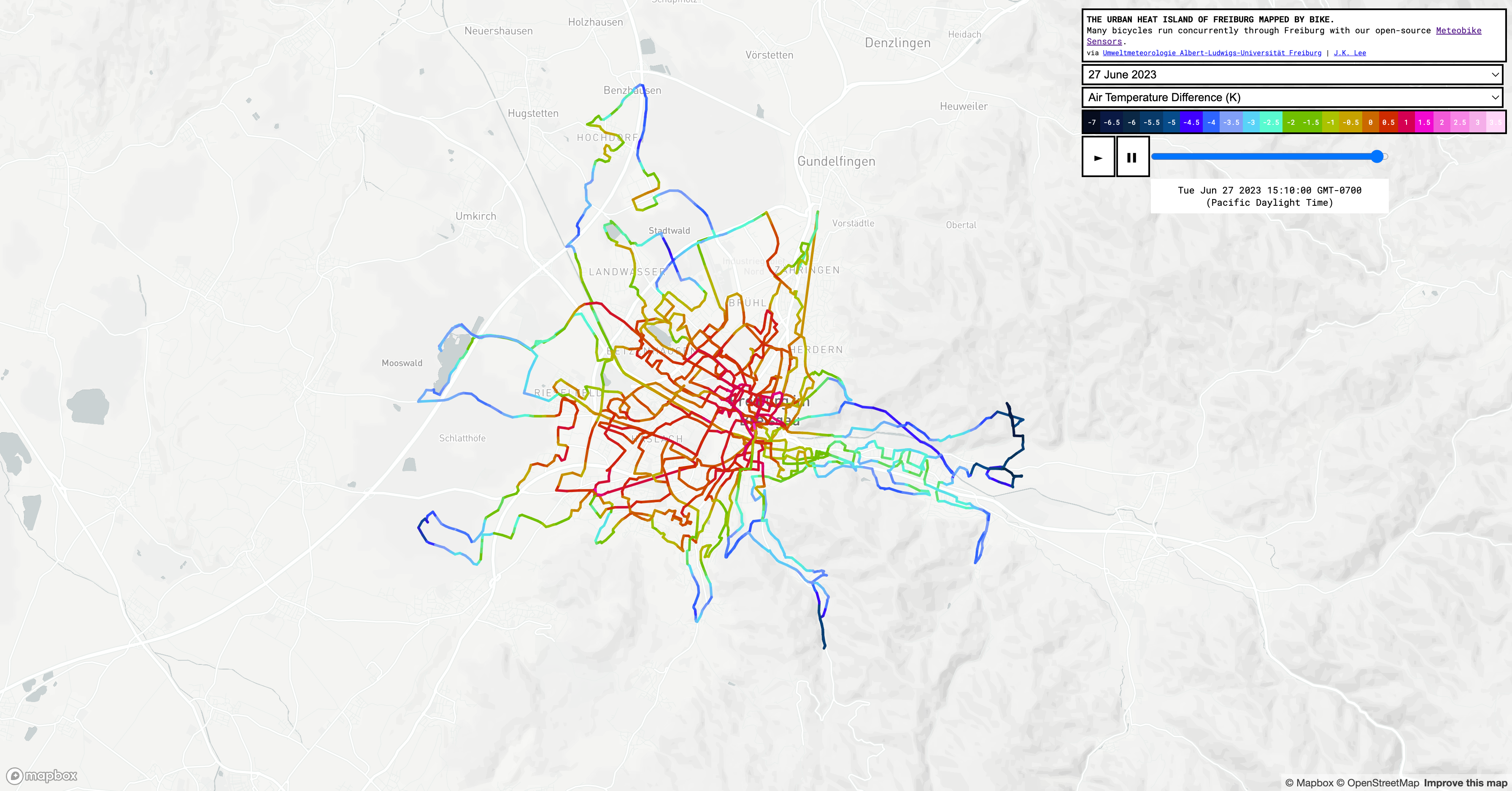
MeteoBike: Urban Heat Island Visualization
A visualization of the urban heat island of Freiburg mapped by bike [U. of Freiburg]
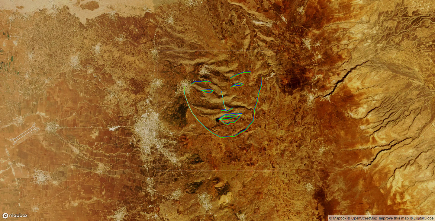
Geography of Hidden Faces
A project about finding faces in the landscape
ml5.js
An opensource library for creative applications of machine learning on the web
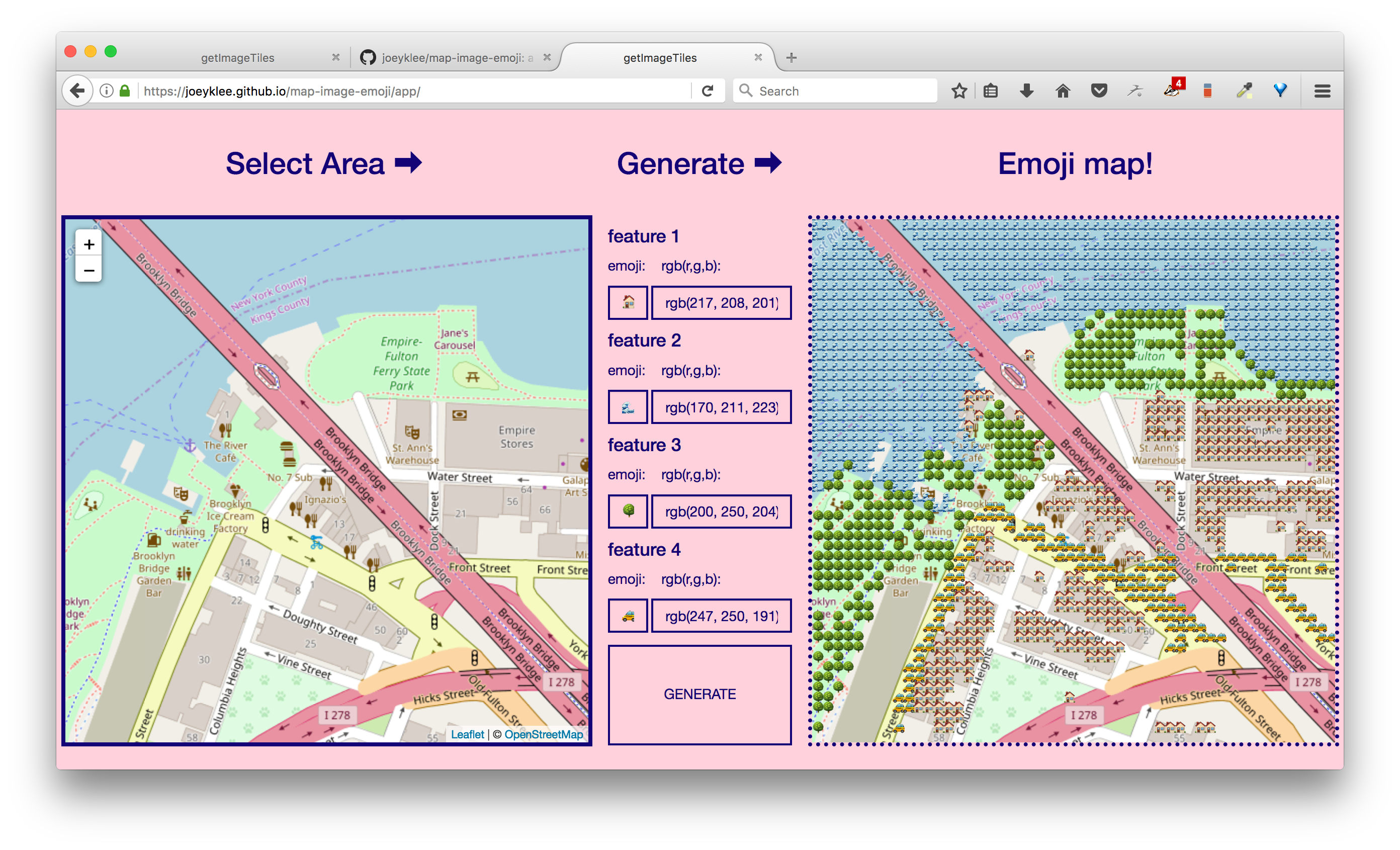
Emoji Map Generator
Canvas based emoji map generator
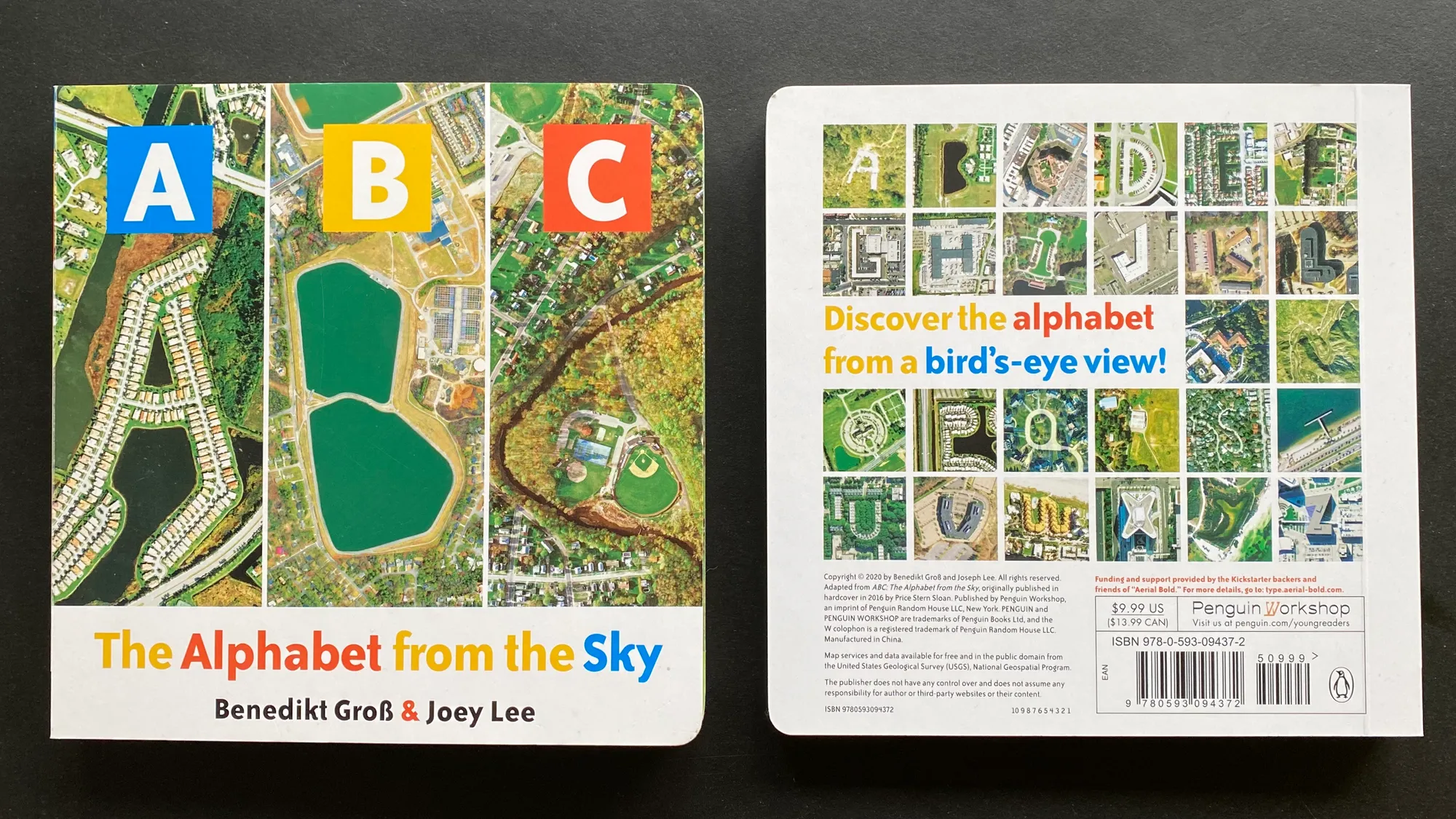
ABC: The Alphabet from the Sky (Board Book)
An ABC book for babies using aerial images
ABC: The Alphabet from the Sky
An ABC book using aerial images
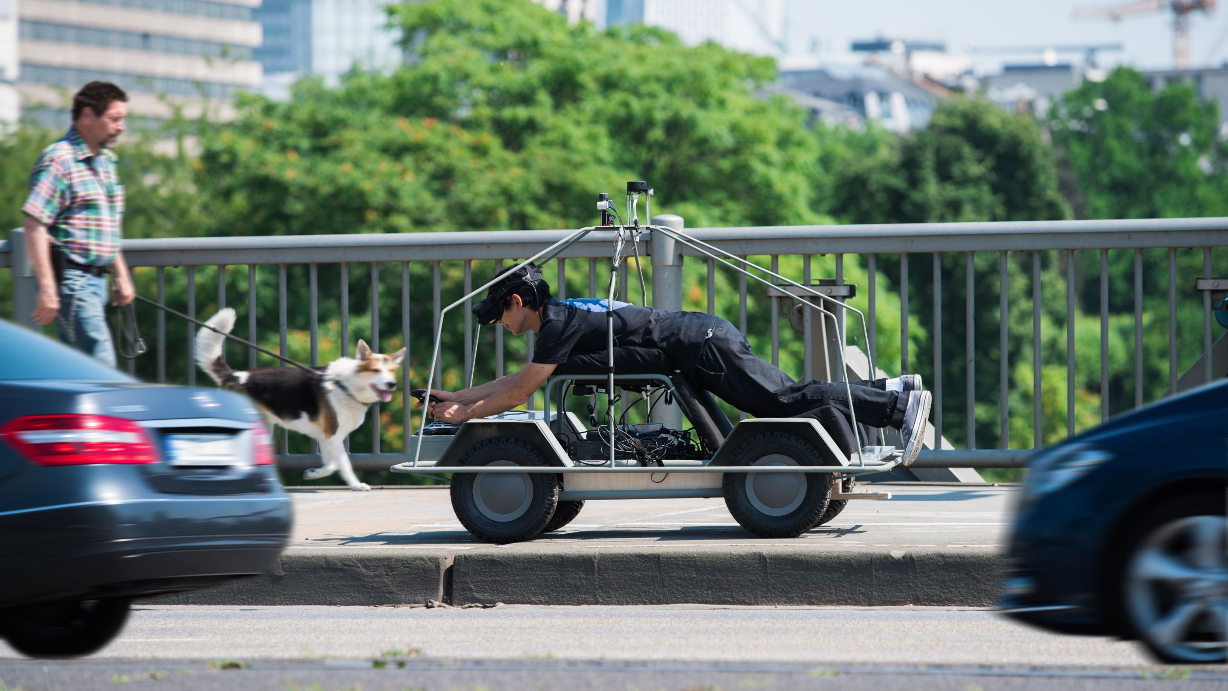
Who Wants to be a Self-driving Car?
A mixed-reality experience about self-driving cars [Moovel Lab]
A mobile sensor network to map carbon dioxide emissions in urban environments
My MSc thesis project
Aerial Bold
The Planetary Search for Letterforms
Generative Design 2.0
Contributions to the second version of Generative Design
The LA Swimmer – 43123 Pools I Have Not Visited and Never Will
A speculative tour of LA swimming pools

Tilehut.js
An open source toolkit for hosting web map tiles
The Big Atlas of LA Pools
The Big Atlas of LA Pools
HubCab: Visualizing 170 Million NYC Taxi Trips
Visualizing 170 million taxi trips in NYC [MIT]
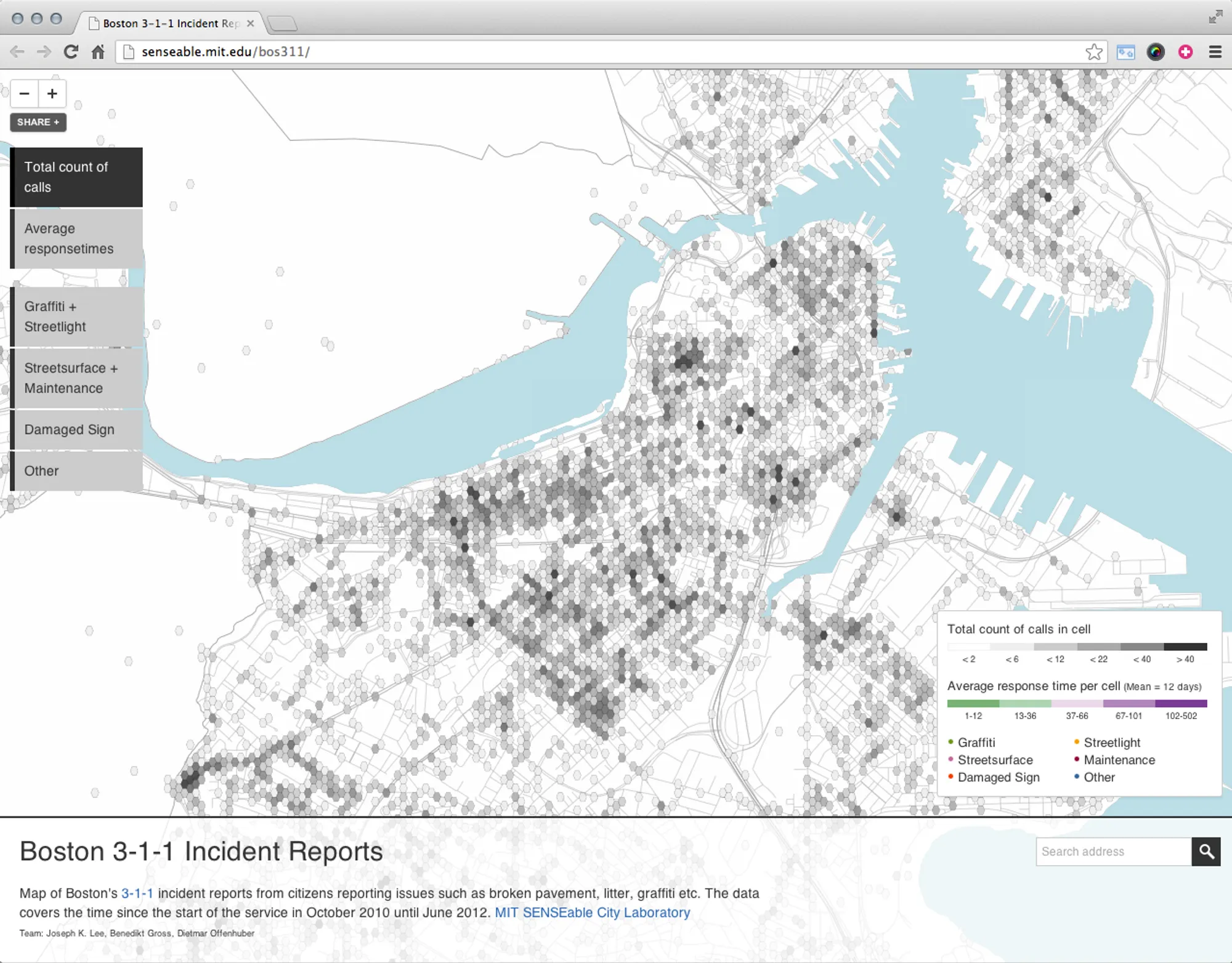
Boston 3-1-1
Visualizing Boston's 3-1-1 requests [MIT]