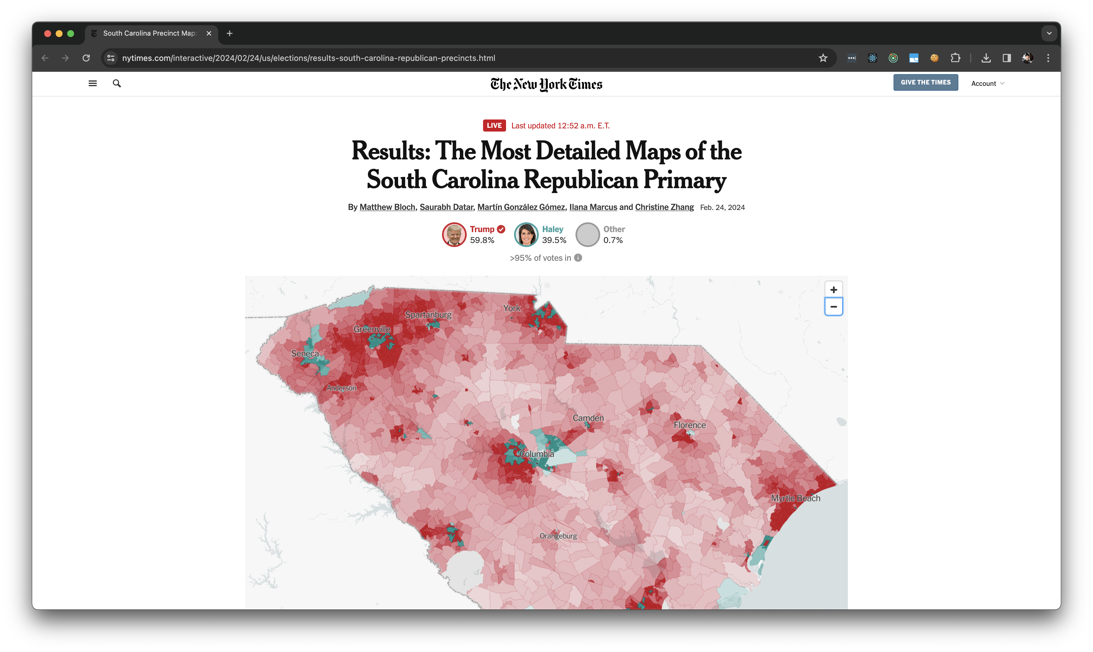
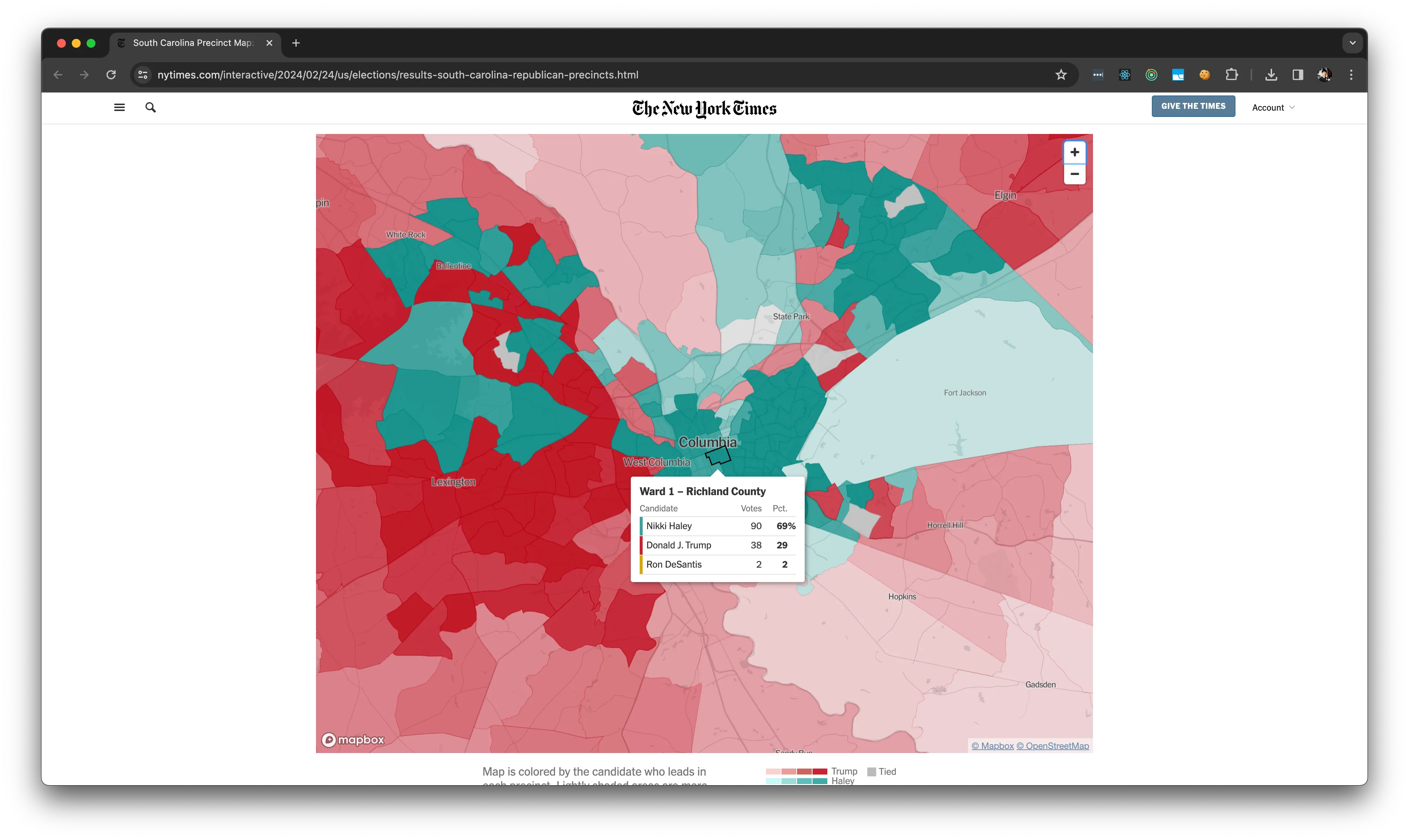
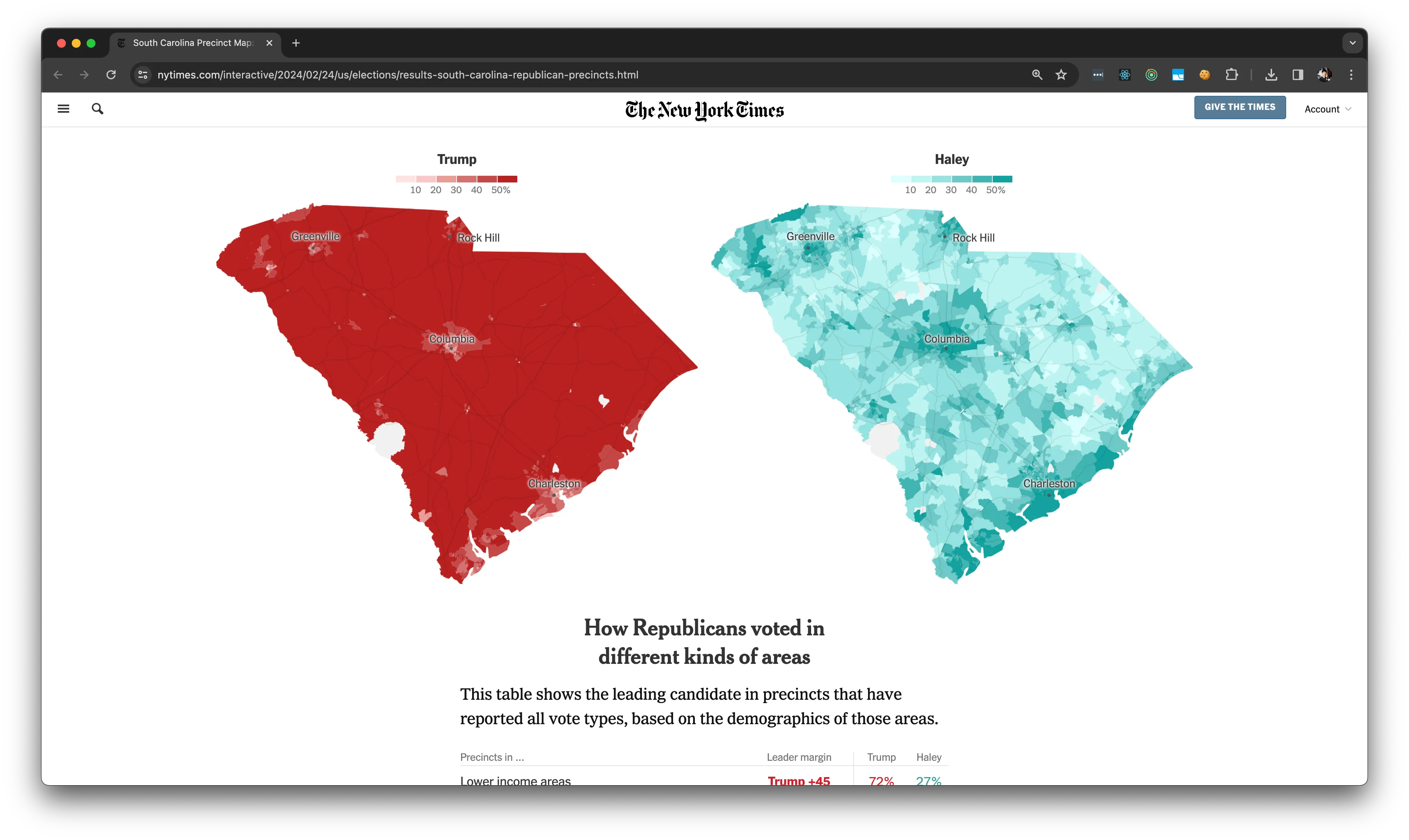
The Most Detailed Maps of the South Carolina Republican Primary
By
By Matthew Bloch, Saurabh Datar, Martín González Gómez, Ilana Marcus and Christine Zhang
Sources
The Associated Press; L2; South Carolina Election Commission; U.S. Census Bureau
Additional work
Nate Cohn, Joey Lee and Elena Shao.
As part of the South Carolina Presidential Primary Elections in February of 2024, I helped to support the Elections Data Scraping team in collecting and processing the precinct level votes and geospatial data needed to power the South Carolina Primary Election Needle and to support the development of this story, ”Results: The Most Detailed Maps of the South Carolina Republican Primary“.
My main contribution to this massive cross-organization effort was to develop what we, at the Times, call a “crosswalk.” A crosswalk is the process of creating the logic for and doing the manual work to create a common unifying identifier between multiple disparate datasets. In this case, the goal was to create a crosswalk for the precinct names between the voting data being published by all the S. Carolina precincts, the GIS data published by the US Census, and the L2 Voter Dataset. In a perfect world, crosswalking would not be necessary, but alas the reality is that typos are abundant, precinct borders change, precinct names change in some sources and not in others, and the list goes on.
This was an exciting opportunity to help support the Graphics and Elections team do some of their most ambitious and sophisticated data reporting to date.
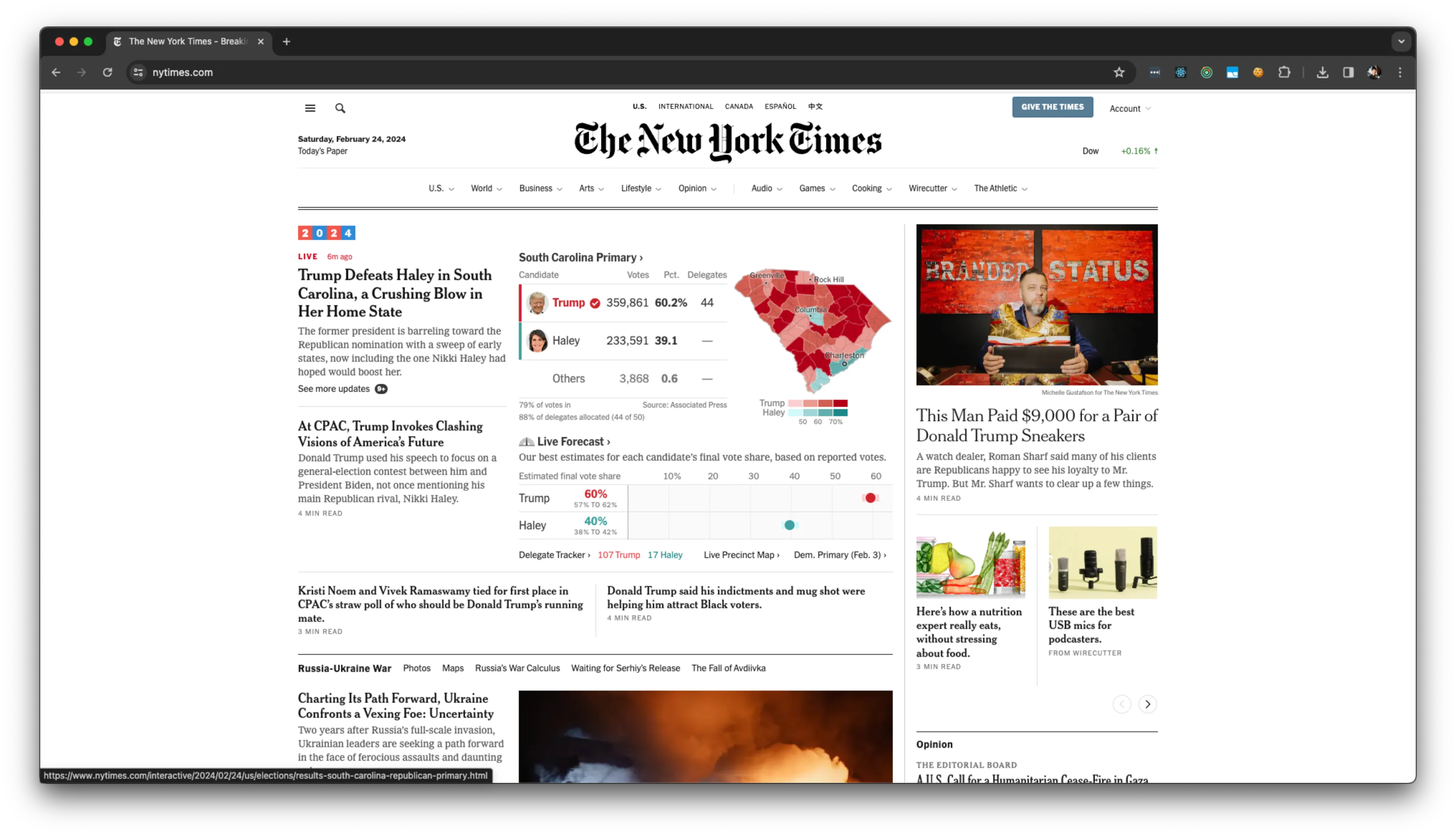
→ Results: The Most Detailed Maps of the South Carolina Republican Primary
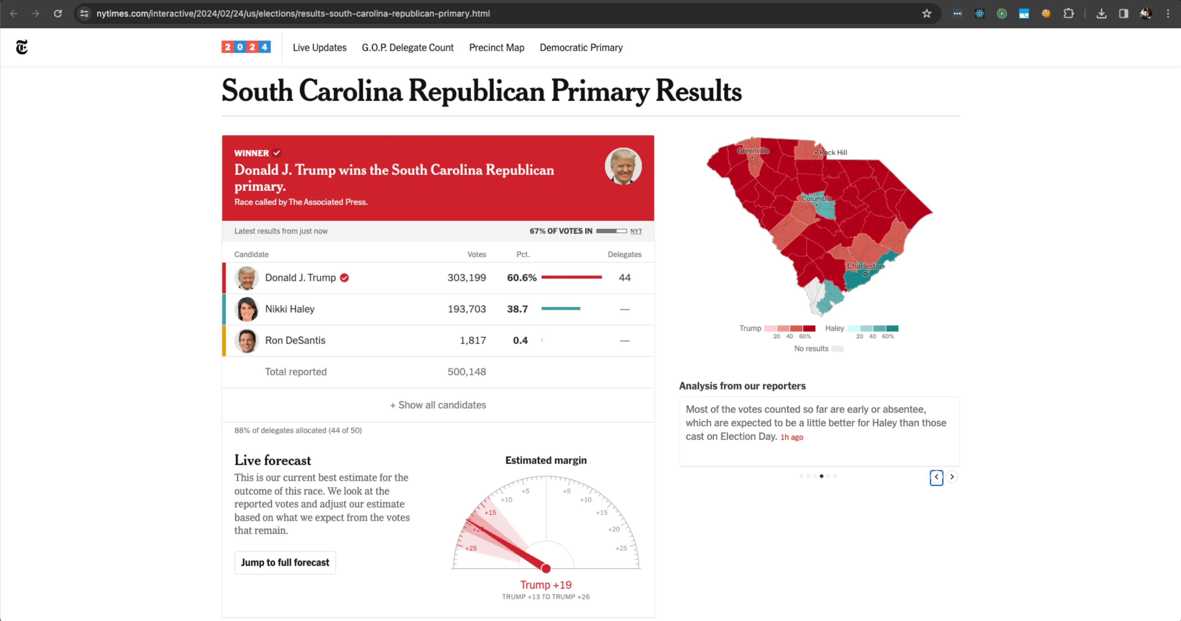
→ South Carolina Republican Primary Results
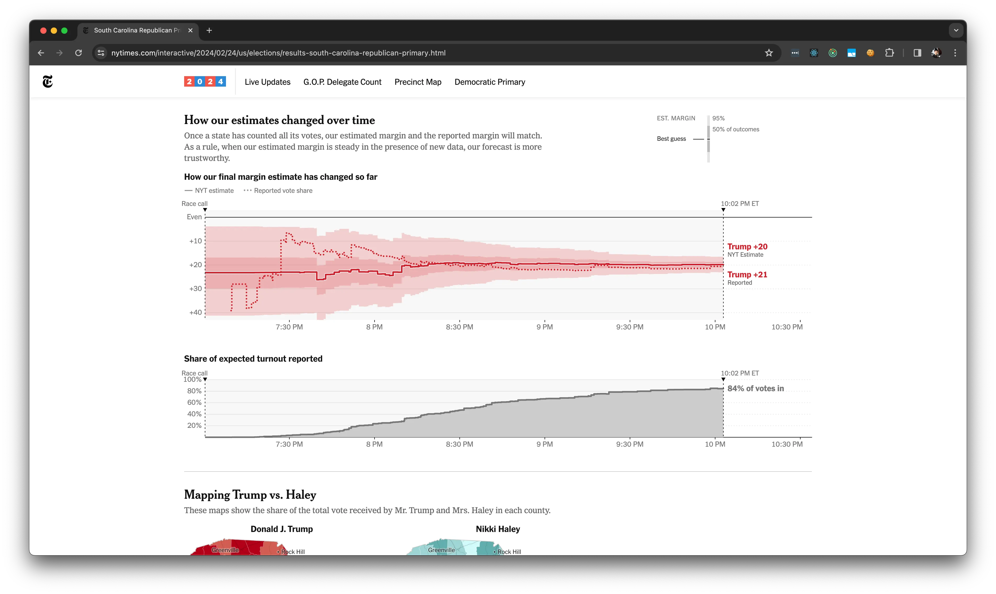
→ How the Needle Works - S.Carolina Primary