A mobile sensor network to map carbon dioxide emissions in urban environments
Concept & Development
Joey Lee,Andreas Christen,Rick Ketler andZoran Nesic
Funding & Support
University of British Columbia,TerreWEB,Mozilla Open Science Fellowship andMoovel Lab (Move Lab x Car2Go)
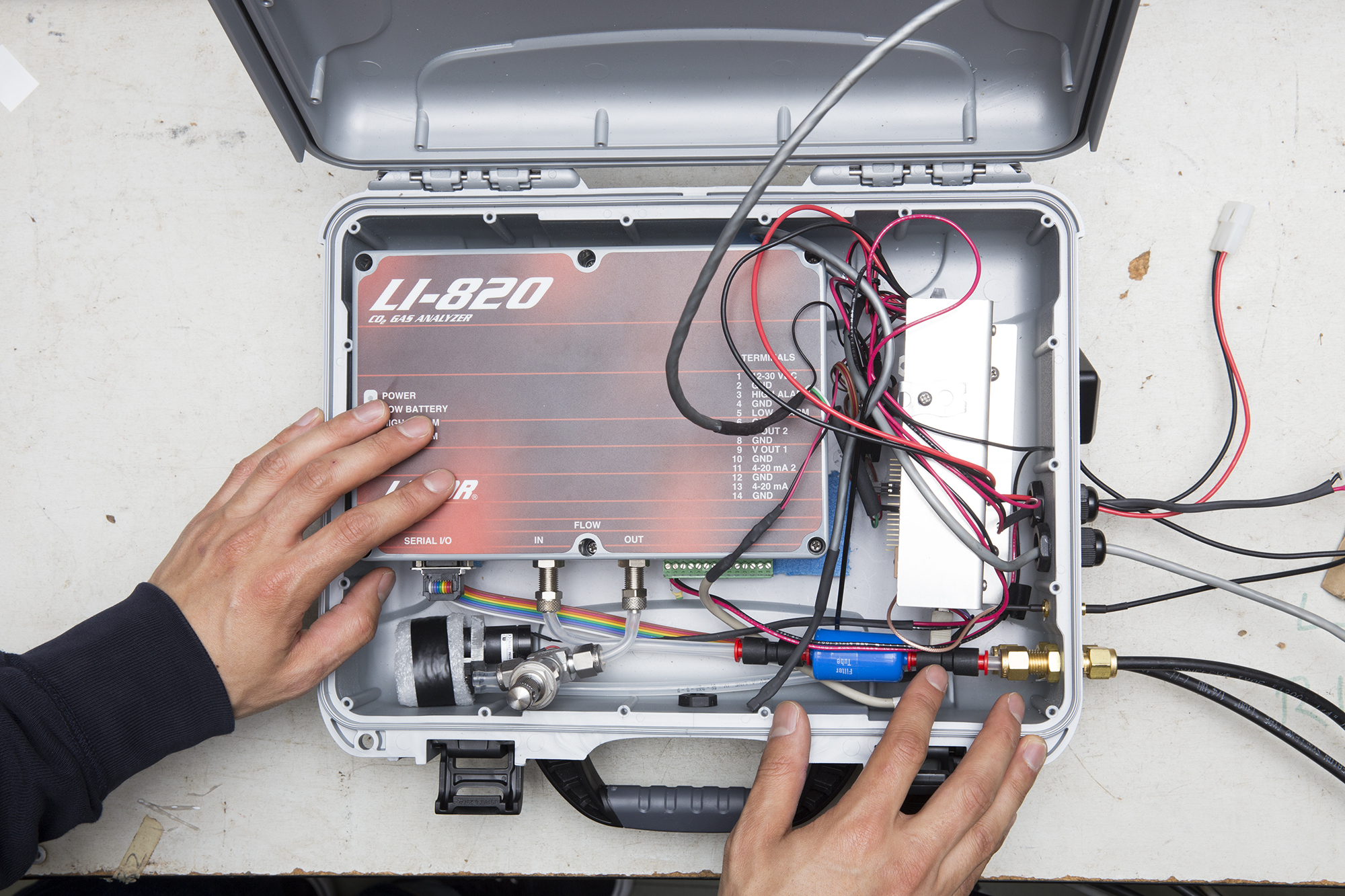
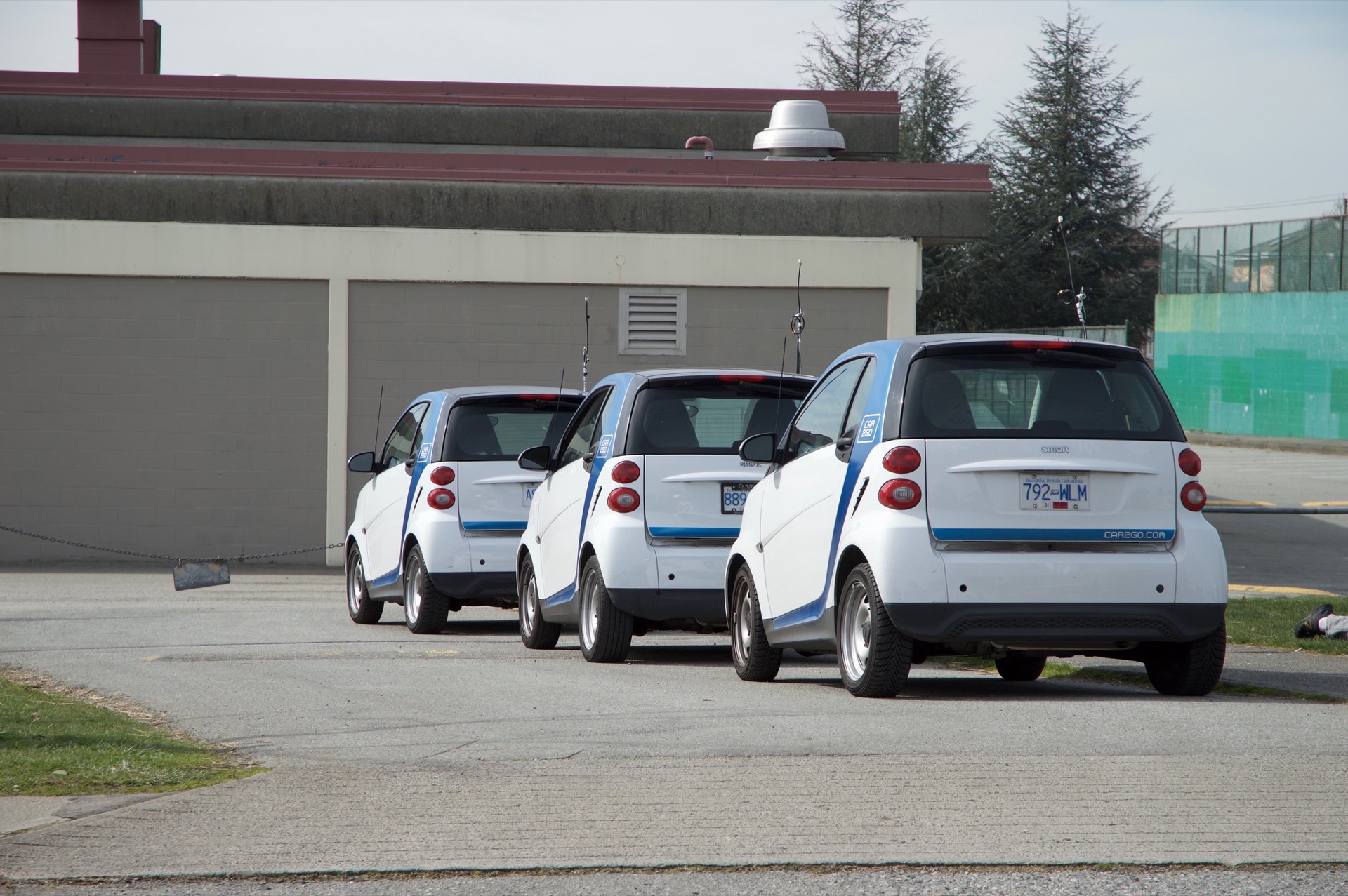
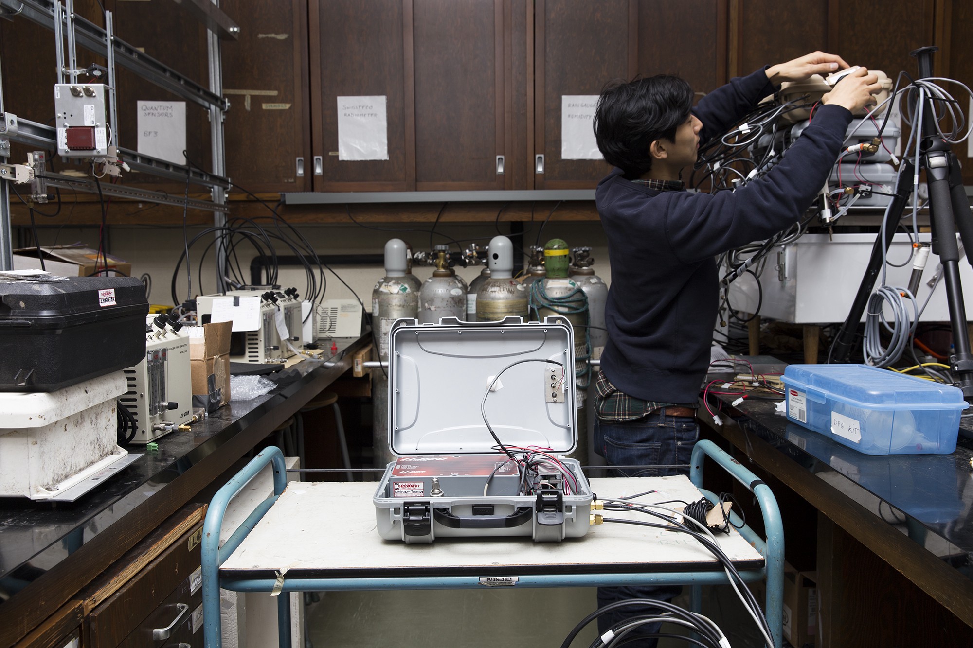
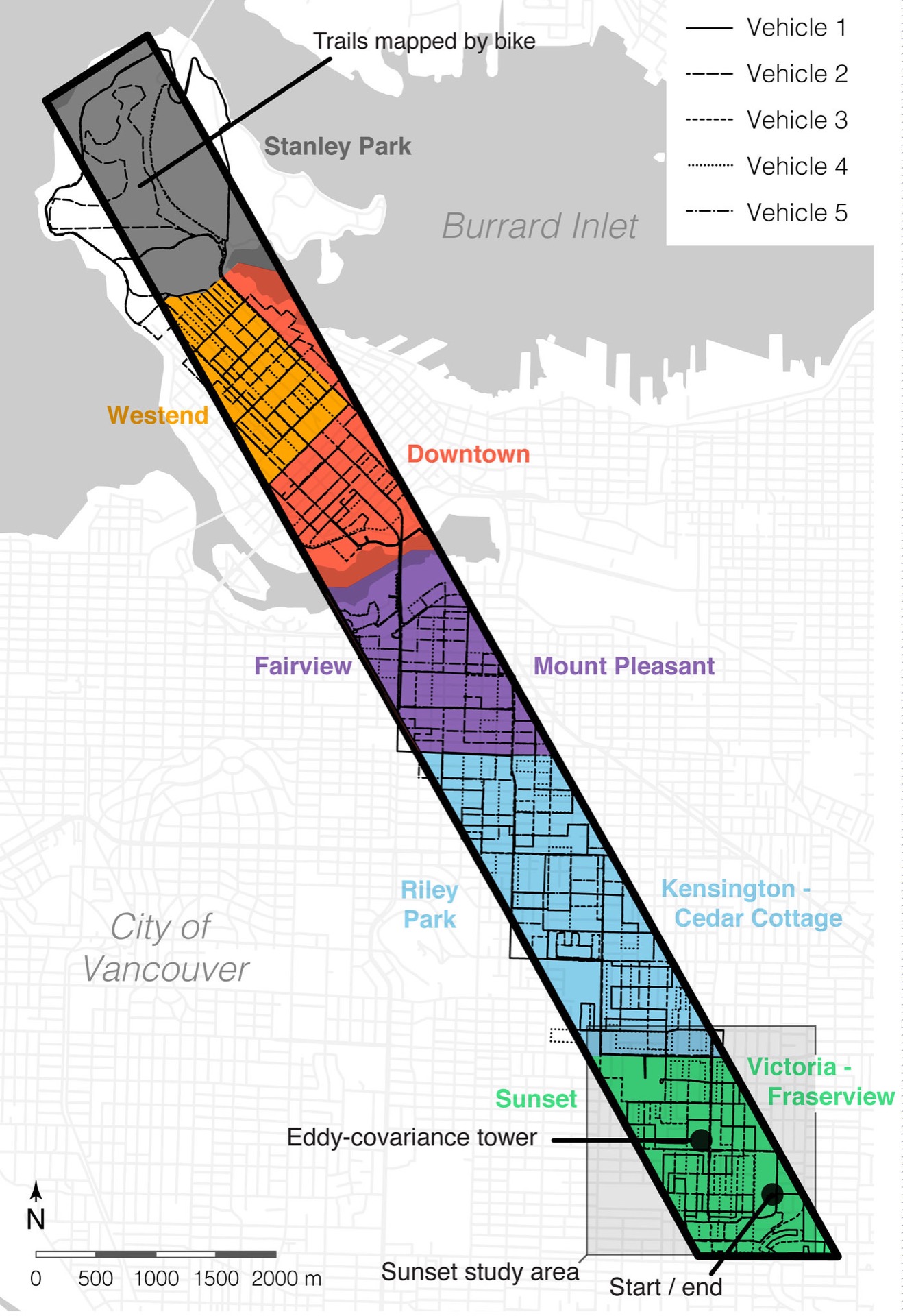
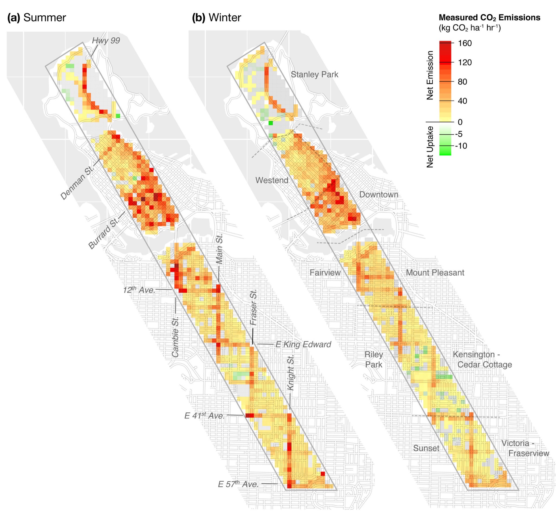
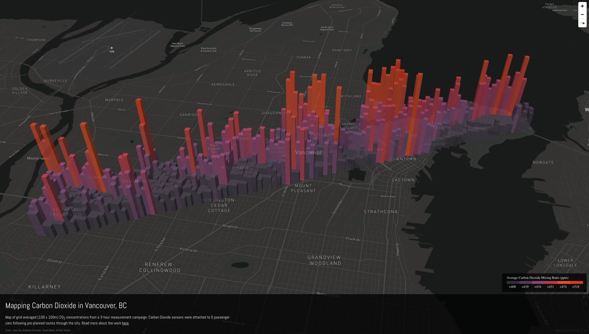
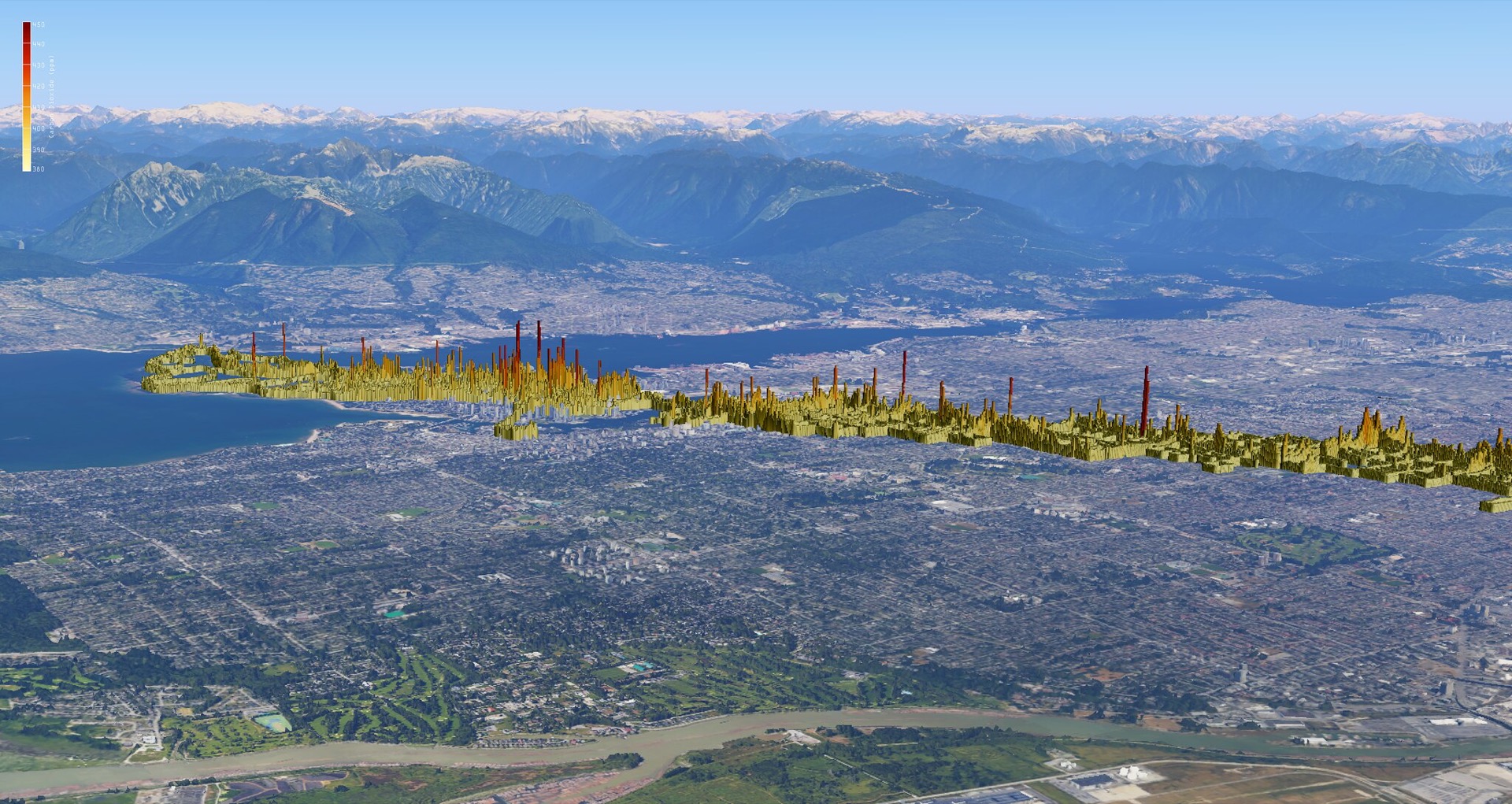
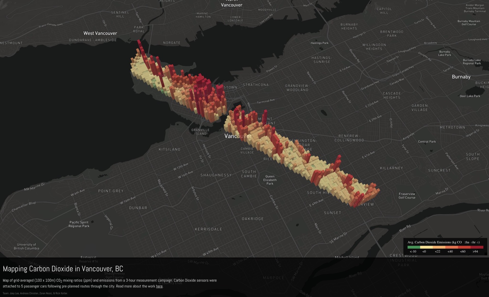
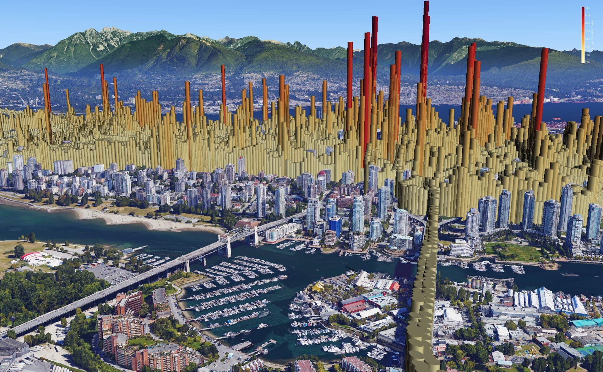
From 2013-2016 I worked on developing methods for monitoring and mapping CO2 emissions at the micro-level (street level) in complex environments. Together with a team of talented and caring supervisors, I developed custom hardware and software and methodologies for collecting, processing, and analyzing CO2 data and weather data.
My work proved that, under specific atmospheric conditions, a well-planned and sufficiently dense network of mobile platforms for monitoring CO2 concentrations can be paired with weather measurements to derive CO2 emissions from CO2 concentrations. My work also highlighted the challenges of urban sensing projects and the non-trivial amount of effort it takes to maintain environmental sensors and the limitations of sensor data without domain knowledge.
The work was experimental in nature and required coordinated measurement campaigns, well calibrated and tested sensor hardware, a well equipped 50m high weather tower, and a dedicated team.
The work we produced was peer-reviewed, accepted by the community, and published.
→ Read the paper at Atmospheric Measurement Techniques
→ Read my thesis work at UBC Thesis Archive
→ Use the interactive map at DISCO2 Viz